
**SNOW IN THE FORECAST** More on that below....
---------------
Looking at a challenging weather day across Tennessee on Tuesday as a cold front will be the culprit which causes the possibility of strong storms, including damaging winds, isolated tornadoes, and large hail. Timing for bad weather will certainly be geared toward the later hours in the day for the Cookeville area and earlier in the day further west toward Nashville. Storms will also rumble in the evening hours here in the Upper Cumberland. I would certainly stay WEATHER AWARE all day long. Looks like, though, we should remain fairly quiet during the first part of Tuesday.

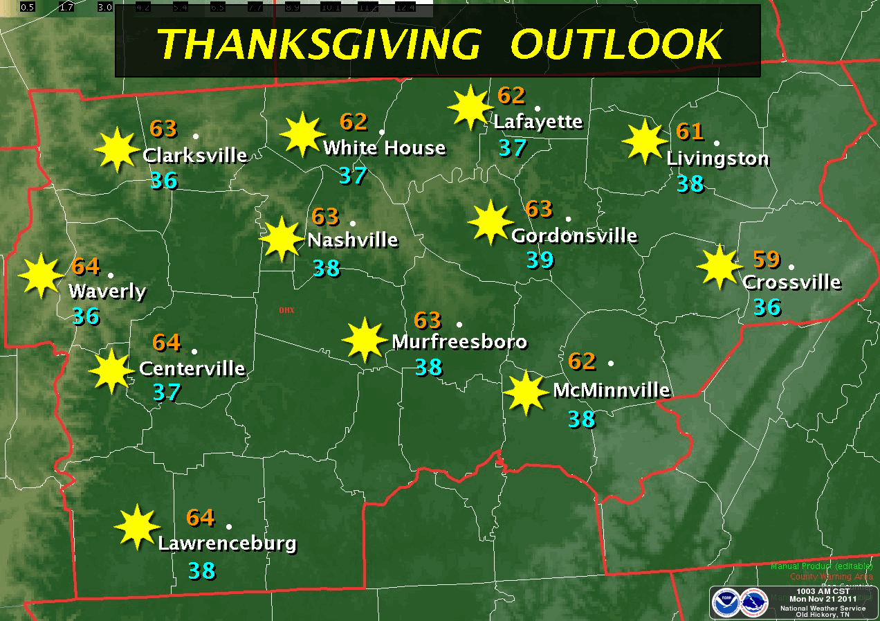
The Thanksgiving Day forecast is going to be one that I think most of you will like. Chilly to start in the morning (good for you hunters) but warming during the afternoon to just above 60° with sunny skies! I call that a good day.
Ok, I've saved the snow part for last. Here is the short version. During the upcoming weekend, we see another strong cold front marching through Tennessee bringing some of the coldest air thus far of the fall season. It appears that it'll affect our weather both Saturday and Sunday. By later Sunday night and Monday, enough cold air will be in place to give us a chance for snow showers. By no means am I expecting any accumulation at this point, however, this system bears watching for now. STAY TUNED!!
Speaking of snow, this is an interesting READ on what this winter could be like! Take note of the last two graphics and the thoughts about Siberian snow in October related to possible colder weather east of the Mississippi during the winter.
No comments:
Post a Comment