
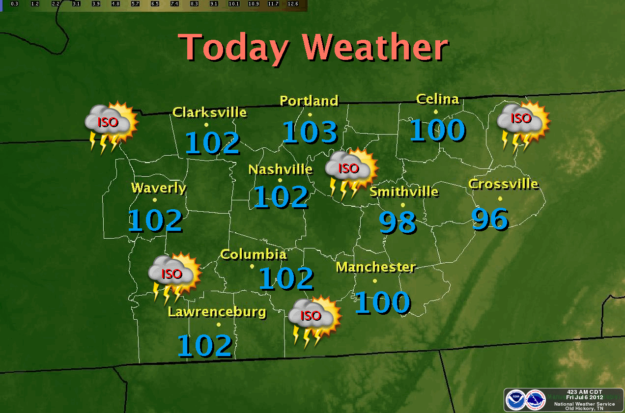
The National Weather Service in Nashville has issued a Heat Advisory effective through midnight on Saturday. Temperatures are expected to top 100° on Friday and Saturday with heat index readings around 105°. The record is 98° from 1936. There is an excellent chance we'll set our sixth high temperature record since late June.
DANGEROUS HEAT:
Heat related illnesses such as heat exhaustion or heat stroke are a real threat. Dehydration can occur quickly. The heat will cause drought conditions to slowly worsen and increase the fire danger. As always, take precautions when working outdoors. Those include frequent breaks, wear light colored and loose fitting clothing when possible and drink plenty of water. Be sure to take frequent breaks in shade or if possible, air-conditioned environments indoors. Remember, heat stroke is an emergency - Call 911
Heat Stroke Signs and Symptoms
RAIN AND COOLER TEMPS:
I expect relief to come to the middle Tennessee area in the form of rain and temperatures falling as much as 15° for highs with rain starting Sunday night and continuing through Tuesday. Highs will only reach the mid 80's on both Monday and Tuesday. Some forecasting models peg our total rainfall for that 60 hour period around 1-2". This would be the most rain to fall in a 2-day period since the middle of March.
*Latest Local Forecast*
Cookeville's Daily Almanac
July 6, 2012
Yesterday's high: 99.8° (another record high)
*The 5th record high this summer*
This morning's low: 65.6°
Normal: 87/65
Records: 98° in 1936 and 51° in 1988
Last year: 87/67
Rainfall
0.00 at my station
(0.04" at a station east of Cookeville)
July total: 0.00
2012 total: 21.94" - (about 10" behind for 2012)
1.97" of rain fell on this date in 1927
So far in July, highs have averaged 98.5°
Interact with me on social media:
Weather Guy on Facebook
Weather Guy on Twitter
Cookeville Weather Alerts on Twitter
No comments:
Post a Comment