
We are stuck in a cold pattern across the mid-south including the middle Tennessee area. There is a Special Weather Statement (see below) for Tuesday night for possible accumulating snow and I expect we will also see a wind advisory issued at some point.
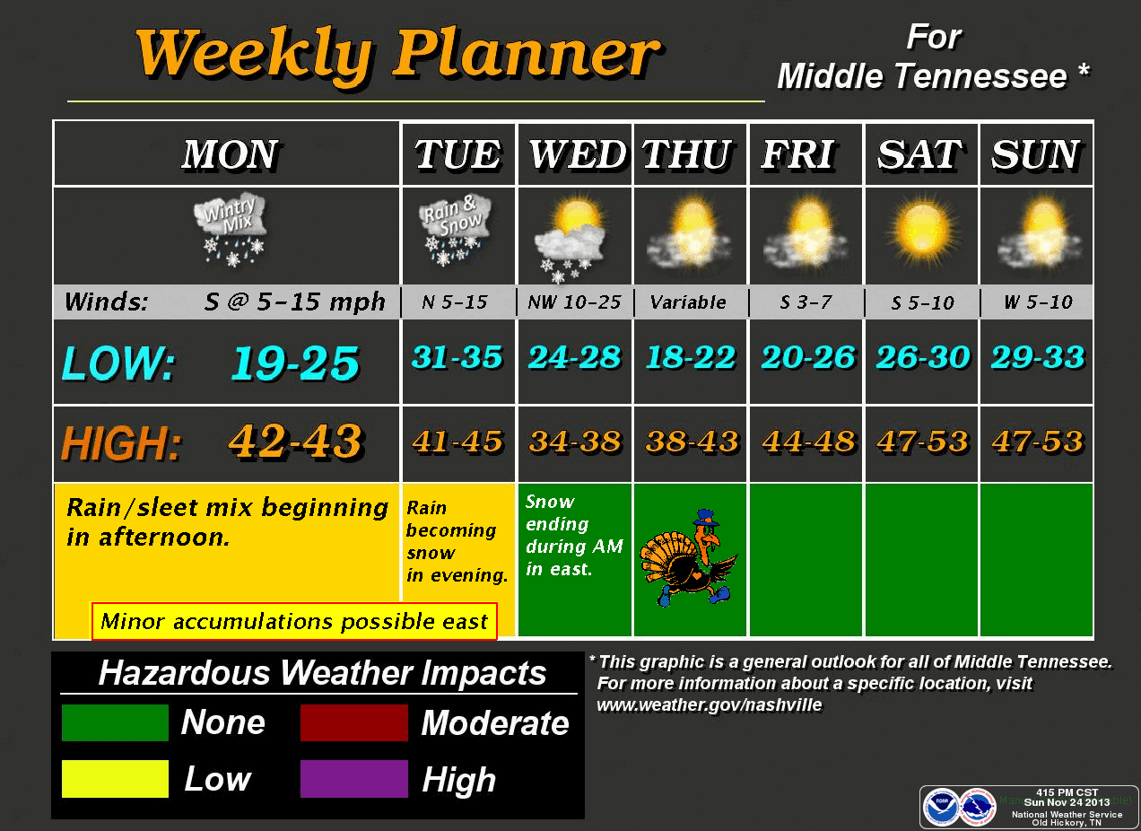
Sunday's high of 32° was 25° BELOW NORMAL in Cookeville.
TONIGHT AND MONDAY:
Expect another cold night with temps dropping to around 22° after midnight but then gradually rise with increasing clouds. Monday will see the clouds continue to increase with a high of 44°. Calm wind to start but becoming southerly around 5 mph.
HERE IS WHERE IT BECOMES COMPLICATED:
A 50/50 chance of rain and sleet on Monday night.
Little or no snow accumulation expected with a low of 33°.
We'll see this mix continue on Tuesday morning but turn to all rain during the mid-morning hours with a high of 43°.
TUESDAY NIGHT SNOW CHANCES:
On Tuesday night, rain turns to a rain/snow mix in the evening and then to all snow after midnight. The low is expected to be around 27° with gusty north winds from 15 to 25 mph. Chance of snow is 50% and some accumulation is possible in higher elevations.
For Wednesday, a chance of snow in the morning and a high of 37° in the afternoon, but it'll be bitterly raw with winds running to 35 mph in gusts. Cold Wednesday night with a low of 21° by Thanksgiving morning.
Expect sunshine and 40° on Thanksgiving Day.
Special Weather Statement
*Latest Local Forecast*
Interact with me on social media:
No comments:
Post a Comment