THE NATIONAL WEATHER SERVICE HAS ISSUED SEVERE THUNDERSTORM WATCH
553 IN EFFECT UNTIL 9 PM CDT THIS EVENING FOR THE FOLLOWING AREAS
IN TENNESSEE THIS WATCH INCLUDES 39 COUNTIES
IN MIDDLE TENNESSEE
BEDFORD BENTON CANNON
CHEATHAM CLAY COFFEE
CUMBERLAND DAVIDSON DEKALB
DICKSON FENTRESS GILES
GRUNDY HICKMAN HOUSTON
HUMPHREYS JACKSON LAWRENCE
LEWIS MACON MARSHALL
MAURY MONTGOMERY OVERTON
PERRY PICKETT PUTNAM
ROBERTSON RUTHERFORD SMITH
STEWART SUMNER TROUSDALE
VAN BUREN WARREN WAYNE
WHITE WILLIAMSON WILSON
THIS INCLUDES THE CITIES OF...ALLARDT...ALTAMONT...ASHLAND CITY...
BRENTWOOD...BYRDSTOWN...CAMDEN...CARTHAGE...CELINA...
CENTERVILLE...CLARKSVILLE...COLUMBIA...COOKEVILLE...CROSSVILLE...
DICKSON...DOVER...ERIN...FRANKLIN...GAINESBORO...GALLATIN...
HARTSVILLE...HOHENWALD...JAMESTOWN...LAFAYETTE...LAWRENCEBURG...
LEWISBURG...LINDEN...LIVINGSTON...LOBELVILLE...MANCHESTER...
MCMINNVILLE...MOUNT JULIET...MURFREESBORO...NASHVILLE...PULASKI...
SHELBYVILLE...SMITHVILLE...SPARTA...SPENCER...SPRINGFIELD...
TENNESSEE RIDGE...TULLAHOMA...WAVERLY...WAYNESBORO AND WOODBURY.
Sent from my Verizon Wireless BlackBerry

Reporting weather from an experienced perspective.
Saturday, July 31, 2010
Saturday Forecast
From National Weather Service
LOOK FOR SCATTERED THUNDERSTORMS TO DEVELOP THROUGH THE AFTERNOON
ACROSS THE MID STATE. A FEW STRONG TO SEVERE STORMS MAY
OCCUR...WITH GUSTY WINDS AND HEAVY DOWNPOURS. OTHERWISE...IT WILL
BE ANOTHER WARM AND HUMID DAY WITH HIGHS RANGING FROM THE MID 80S
PLATEAU TO THE MID 90S OVER THE SOUTHWEST COUNTIES.
Sent from my Verizon Wireless BlackBerry
Heavy Rain on Saturday!

Shot from downtown Cookeville of heavy rains...visibility less than 1/4 mile.
*Latest Local Forecast*
Wednesday, July 28, 2010
Weather Alert
SPECIAL WEATHER STATEMENT
NATIONAL WEATHER SERVICE NASHVILLE TN
616 PM CDT WED JUL 28 2010
NATIONAL WEATHER SERVICE NASHVILLE TN
616 PM CDT WED JUL 28 2010
TNZ005>008-026>030-032-062>064-078-282345-
CANNON-CHEATHAM-DAVIDSON-DEKALB-MONTGOMERY-PUTNAM-ROBERTSON-
RUTHERFORD-SMITH-STEWART-SUMNER-TROUSDALE-WARREN-WILSON-
616 PM CDT WED JUL 28 2010
...SIGNIFICANT WEATHER ADVISORY FOR CANNON...CHEATHAM...DAVIDSON...
DEKALB...MONTGOMERY...PUTNAM...ROBERTSON...RUTHERFORD...SMITH...
STEWART...SUMNER...TROUSDALE...WARREN AND WILSON COUNTIES...
AT 613 PM CDT...NATIONAL WEATHER SERVICE DOPPLER RADAR WAS TRACKING
A GUST FRONT EXTENDING FROM 6 MILES SOUTHWEST OF SMITHVILLE TO 11
MILES SOUTHWEST OF FORT CAMPBELL NORTH...MOVING SOUTHWEST AT 25 MPH.
LOOK FOR WINDS AROUND 40 MPH MOVE INTO NORTHERN DAVIDSON COUNTY BY
630 PM. OTHER AREAS AFFECTED BY GUSTY WINDS WILL
BE...LEBANON...ASHLAND CITY...CLARKSVILLE...AND CARTHAGE.
Sent from my Verizon Wireless BlackBerry
Continued Hot with Possible Storms

We've topped 90° during 16 of the 27 days thus far in July and expect today to be right around the 90° mark once again.
Our hottest July day has been 97° on 16th. Looking at our 7-day forecast, we'll see this heat continue throughout the period. Highs are averaging 89.6° during this month compared with an average of 87.7°, just about 2° above normal.
The record year occurred in 1980 when our average day was 93.9°. Compare that with last July (one of the coolest on record) when our average high was only 81.9°.
NEXT 24 HOURS:
Not much change in the forecast as we expect thunderstorms to once again boil and roil in the afternoon heat. Most of us will not see a drop of rain but the folks who do should get heavy rains. Again, expect highs right around 90° with heat index readings near 100°.
*Latest Local Forecast*
National Weather Service confirms EF-1 tornado in Nashville on Monday evening.
Don't forget about the Spotter's Training Class at TTU in Cookeville on August 12th
Cookeville's Daily Almanac
Yesterday's high: 89.9°
Yesterday's low: 72.6°
Normal High: 88°
Record: 105° in 1930
Normal Low: 65°
Record: 52° in 1962
Last Year: 85° and 64°
2.00" of rain fell on this date in 2007
--------------------------------------------------
Join me on:
Facebook Twitter LinkedIn Examiner.com Nashville Weather CookevilleTimes Weather My Google Profile
Tuesday, July 27, 2010
Public Information Statement
Concerning reported tornado last evening.
PUBLIC INFORMATION STATEMENT...CORRECTED
NATIONAL WEATHER SERVICE NASHVILLE TN
1003 AM CDT TUE JUL 27 2010
...PUBLIC INFORMATION STATEMENT...
A NATIONAL WEATHER SERVICE STORM TEAM HAS COMPLETED THE SURVEY OF
STORM DAMAGE IN DAVIDSON COUNTY IN THE VICINITY OF BRICK CHURCH PIKE
AND WESTCHESTER DRIVE. THE PRELIMINARY FINDING INDICATES A TORNADO
OCCURRED IN THIS AREA EARLY YESTERDAY EVENING.
MORE INFORMATION WILL BE AVAILABLE LATER TODAY.
Sent from my Verizon Wireless BlackBerry
Hot Again With Possible Storms
HEAVY RAIN POSSIBLE:
Watch for big storms today in some locations as we'll see highs around 90°. The remnants of Tropical Storm Bonnie continue to affect our area. With very little in the way of upper level winds, many of these storms will move very slowly causing some locations to have flooding-type conditions. Heat Index readings will push 100° once again.
NASHVILLE TORNADO:
An apparent weak tornado spun up around 7 pm last evening in the north Nashville area. One tractor-trailer was overturned and as many as 15 homes were damaged in the Brick Church Pike area. The Nashville office of the National Weather Service will be out this morning surveying damage to determine just what happened.
Cookeville's Daily Almanac
Yesterday's high: 92.2°
Yesterday's low: 74.7°
Normal High: 88°
Record: 101° in 1930
Normal Low: 65°
Record: 53° in 1962
Last Year: 81° and 65°
3.23" of rain fell on this date in 1984
--------------------------------------------------
Join me on:
Facebook Twitter LinkedIn Examiner.com Nashville Weather CookevilleTimes Weather My Google Profile
Monday, July 26, 2010
Still Hot and Humind
SLIGHT RAIN CHANCES:
Look for the chance for rain to increase today with even better odds for Tuesday and Wednesday. Highs will be quite warm with daytime temps topping out around 90°-92° each day. Overnight lows in the lower to middle 70's. Remnants of Tropical Depression Bonnie are the cause for the increased chances. Some predictions (like News 2) show us receiving up to 1" of rain over the next two days. Lets hope they are correct.
Cookeville's Daily Almanac
Yesterday's high: 95.2°
Yesterday's low: 74.4°
Normal High: 88°
Record: 96° in 1966
Normal Low: 65°
Record: 55° in 1924
Last Year: 87° and 66°
4.14" of rain fell on this date in 1973
Temperatures are running 1.5° above normal for July
Contrast that with last year when they were 5° BELOW normal
--------------------------------------------------
Join me on:
Facebook Twitter LinkedIn Examiner.com Nashville Weather CookevilleTimes Weather My Google Profile
Friday, July 23, 2010
A Hot Day To Remember
FAST FACTS FROM TODAY'S HEAT!
*Latest Local Forecast*
--------------------------------------------------
Join me on:
Facebook Twitter LinkedIn Examiner.com Nashville Weather CookevilleTimes Weather My Google Profile
- Hit 80° at 7:25 am, 85° by 8:50 am, 90° at 10:20 am, 95° at 3:20 pm
- Hit 96° at 3:30 pm for our high temperature
- Stayed above 80° from 7:25 am until 9:03 pm for a total of 13 and 1/2 hours
- Stayed above 90° from 10:20 am until 7:30 pm for 9 hours 10 minutes
- Heat Index above 100° for 8 straight hours
And now for the good news, we get to do it all over again on Saturday with a bonus!! Add a couple more degrees to these temps!! Not much in the way of relief for Sunday as temps will be around 94° with a heat index around 100°. A stray shower or two may cool things briefly.
*Latest Local Forecast*
--------------------------------------------------
Join me on:
Facebook Twitter LinkedIn Examiner.com Nashville Weather CookevilleTimes Weather My Google Profile
Hottest Two Days This Year
HIGH HUMIDITY & HIGH TEMPS:
Expect to see us reach the middle 90's here in Cookeville today. We're already seeing temperatures rising into the 80's this morning. We'll repeat these highs with a degree or two more on Saturday. Heat Index Readings (feels like) will run between 105 to 110 for most of us. No rain chances for the next two days. The National Weather Service in Nashville has issued a HEAT ADVISORY for all of Middle TN (not including Putnam)
TROPICAL STORM BONNIE:
It is possible that by Tuesday TS Bonnie will be affecting our weather. We'll watch that and keep you updated.
Cookeville's Daily Almanac
This morning's low: 71.8°
Yesterday's high: 91.6°
Yesterday's low: 70.5°
Normal High: 88°
Record: 99° in 1983
Normal Low: 66°
Record: 54° in 2007
Last Year: 75° and 66°
1.68" of rain fell on this date in 1953
As hot as it's been, we're only 1° above normal for July
--------------------------------------------------
Join me on: Facebook Twitter LinkedIn Examiner.com Nashville Weather CookevilleTimes Weather My Google Profile
Thursday, July 22, 2010
Strong Storms Possible Again
HEAT CONTINUES:
Look for the possibility of strong storms to develop again this afternoon. The best chances will be here on the Highland Rim and locations to our north. Highs will be in the 90's for all of us. 92° in Cookeville with higher temperatures toward Nashville and slightly lower temps north and east of us. A sneak peek into Friday shows this could be our hottest day yet of the year.
YESTERDAY'S RAINS:
With the additional .44" received late afternoon on Wednesday, it brings our monthly total up to 5.77 for July.
Join me on:
Facebook Twitter LinkedIn Examiner.com Nashville Weather CookevilleTimes Weather My Google Profile
Wednesday, July 21, 2010
Storms Moving In
Special Weather Statement
as of 1:30 PM CDT on July 21, 2010
... Significant weather advisory for Clay... Cumberland... Fentress...
Jackson... Macon... Overton... Pickett... Putnam... Smith... Sumner...
Trousdale and white counties...
A weak surface boundary moving into middle Tennessee will bring
strong thunderstorms to the area. The strongest of these storms will
affect areas north of a line extending from Portland, to Carthage,
to Sparta. This afternoon's storms will be capable of producing
extremely high rainfall rates, as much as 2 to 3 inches in an hour.
So brief, localized flooding is possible in these areas.
More Hot Weather Ahead
HEAT AND STORMS
Temperatures are expected to reach in the 90's once again. We've been at 85° or higher every single day in July with the exception of the July 1st. The Storm Prediction Center does have us under a slight chance for strong storms within a 25 mile radius of any given location in Middle Tennessee. Most of our area is under either a SPECIAL WEATHER STATEMENT, HEAT ADVISORY, OR EXCESSIVE HEAT WATCH for today. Here in Putnam County, you can view the HAZARDOUS WEATHER OUTLOOK.The hottest of our temperatures is expected to arrive by Friday where many locations could see middle and upper 90's with 100° readings possible in the cities like Nashville, Clarksville, Jackson, and Memphis.
STORM SPOTTER TRAINING:
The latest storm spotter training class has been announced. It will be on August 12th (9:30 am CDT) at the TTU Nursing Building Auditorium on the campus of Tennessee Tech University in Cookeville.Need directions?
Need more information?
E-mail Tom Johnstone with the National Weather Service office in Nashville.
Cookeville's Daily Almanac
This morning's low: 73.7°
Yesterday's high: 90.6°
Yesterday's low: 73.3°
Normal High: 88°
Record: 101° in 1926
Normal Low: 66°
Record: 54° in 2009
Last Year: 78° and 54°
3.25" of rain fell on this date in 1917
5.33" so far this month (July 2010)
34.17" so far in 2010 (right about normal)
On this date last year, it was the 2nd straight record low temperature!
--------------------------------------------------
Join me on:
Tuesday, July 20, 2010
Next Few Hours & Overnight...
OVERTON-PICKETT-PUTNAM-WARREN-WHITE-
INCLUDING THE CITIES OF...BYRDSTOWN...COOKEVILLE...LIVINGSTON...
MCMINNVILLE...SPARTA
330 PM CDT TUE JUL 20 2010
INCLUDING THE CITIES OF...BYRDSTOWN...COOKEVILLE...LIVINGSTON...
MCMINNVILLE...SPARTA
330 PM CDT TUE JUL 20 2010
.THROUGH LATE AFTERNOON...PARTLY CLOUDY WITH SCATTERED SHOWERS AND
THUNDERSTORMS. SOUTHWEST WINDS 5 TO 10 MPH. CHANCE OF RAIN
30 PERCENT.
.TONIGHT...PARTLY CLOUDY. SCATTERED SHOWERS AND THUNDERSTORMS IN THE
EARLY EVENING. LOWS IN THE LOWER 70S. SOUTH WINDS 5 TO 10 MPH.
CHANCE OF RAIN 30 PERCENT.
Sent from my Verizon Wireless BlackBerry
Hot Weather Rest Of Week

There is a Heat Advisory just one county to our west for today while southern Middle TN and Northern Alabama are under an Excessive Heat Watch. Here in the Cookeville area, we can't rule out a shower or thunderstorm this afternoon with highs running near 90°. Storms possible before 10 pm this evening, low 73°, hot again on Wednesday with a high of 91° and a chance of storms.
Note the graphic above. At just 80° in the sunshine, the temperature inside of a car will rise to 123° in just 60 minutes. This is a huge danger to children and pets left unattended. Don't make a mistake you'll regret.
Cookeville's Daily Almanac
Yesterday's high: 89.0°
Yesterday's low: 70.5°
Normal High: 88°
Record: 101° in 1980
Normal Low: 66°
Record: 53° in 2009
Last Year: 74° and 53°
1.70" of rain fell on this date in 1955
5.33" has been recorded so far in July 2010
Do you remember the very cool and wet July 2009? That's right, just last year on this date, our low was a cool 53° while the high was just 74°. Temperatures averaged 5° below normal for the month!
--------------------------------------------------
Join me on:
Monday, July 19, 2010
Weather Alert
At 10:07 pm, things have settled down over the last hour. While we could see a random shower or thunderstorm, most have dissipated or have moved to our north or east.
More updates later, if needed.
SPECIAL WEATHER STATEMENT
NATIONAL WEATHER SERVICE NASHVILLE TN
910 PM CDT MON JUL 19 2010
TNZ011-028-030>034-064>066-200315-
CUMBERLAND-DEKALB-FENTRESS-JACKSON-OVERTON-PICKETT-PUTNAM-SMITH-
WHITE-WILSON-
910 PM CDT MON JUL 19 2010
...SIGNIFICANT WEATHER ADVISORY FOR CUMBERLAND...DEKALB...FENTRESS...
JACKSON...OVERTON...PICKETT...PUTNAM...SMITH...WHITE AND WILSON
COUNTIES...
AT 906 PM CDT...NATIONAL WEATHER SERVICE DOPPLER RADAR WAS TRACKING
STRONG THUNDERSTORMS ALONG A LINE EXTENDING FROM 9 MILES NORTH OF
JAMESTOWN TO WATERTOWN...MOVING SOUTHEAST AT 25 MPH.
SOME STORMS MAY HAVE WINDS 30 TO 40 MPH...FREQUENT LIGHTNING AND LOCALLY
HEAVY RAINFALL.
Sent from my Verizon Wireless BlackBerry
More Storms (Intense)
SPECIAL WEATHER STATEMENT
NATIONAL WEATHER SERVICE NASHVILLE TN
816 PM CDT MON JUL 19 2010
NATIONAL WEATHER SERVICE NASHVILLE TN
816 PM CDT MON JUL 19 2010
TNZ009>011-031-033-034-200215-
CLAY-FENTRESS-JACKSON-MACON-OVERTON-PICKETT-
816 PM CDT MON JUL 19 2010
...SIGNIFICANT WEATHER ADVISORY FOR CLAY...FENTRESS...JACKSON...
MACON...OVERTON AND PICKETT COUNTIES...
AT 812 PM CDT...NATIONAL WEATHER SERVICE DOPPLER RADAR WAS TRACKING
STRONG THUNDERSTORMS ALONG A LINE EXTENDING FROM 17 MILES NORTH OF
ALBANY TO 6 MILES NORTHEAST OF RED BOILING SPRINGS...MOVING
SOUTHEAST AT 20 MPH.
A FEW STORMS MAY HAVE WINDS 40 TO 50 MPH...FREQUENT LIGHTNING AND
LOCALLY HEAVY RAINFALL.
Sent from my Verizon Wireless BlackBerry
Storms Overnight
FLOODING RAINS OVER UPPER CUMBERLAND:
If you slept through the storms overnight, consider yourself one of the few. An incredible display of lightning, thunder, & very heavy rains. At times, tornado warning were issued for Macon and Jackson Counties. For a times, Putnam County was under a flash flood warning as storms dropped more than 2.5" of rain in about 40 minutes. ***LONG LIST OF STORM REPORTS*** ...Red Boiling Springs recorded more than 5" of rain overnight.
Expect a hot week with heat index readings to top 100°....
--------------------------------------------------
Join me on:
Facebook Twitter LinkedIn Examiner.com Nashville Weather CookevilleTimes Weather My Google Profile
Flash Flood Warning
BULLETIN - EAS ACTIVATION REQUESTED
FLASH FLOOD WARNING
NATIONAL WEATHER SERVICE NASHVILLE TN
302 AM CDT MON JUL 19 2010
FLASH FLOOD WARNING
NATIONAL WEATHER SERVICE NASHVILLE TN
302 AM CDT MON JUL 19 2010
THE NATIONAL WEATHER SERVICE IN NASHVILLE HAS ISSUED A
* FLASH FLOOD WARNING FOR...
EASTERN PUTNAM COUNTY IN MIDDLE TENNESSEE...
THIS INCLUDES THE CITY OF COOKEVILLE...
* UNTIL 600 AM CDT
* AT 301 AM CDT...NATIONAL WEATHER SERVICE DOPPLER RADAR INDICATED
FLASH FLOODING FROM THUNDERSTORMS NEAR COOKEVILLE...MOVING
SOUTHEAST AT 20 MPH.
* THE THUNDERSTORM PRODUCING FLASH FLOODING WILL BE NEAR...
MONTEREY BY 330 AM CDT...
PRECAUTIONARY/PREPAREDNESS ACTIONS...
EXCESSIVE RUNOFF FROM HEAVY RAINFALL WILL CAUSE FLOODING OF SMALL
CREEKS AND STREAMS...HIGHWAYS AND UNDERPASSES. ADDITIONALLY...COUNTRY
ROADS AND FARMLANDS ALONG THE BANKS OF CREEKS...STREAMS AND OTHER LOW
LYING AREAS ARE SUBJECT TO FLOODING.
&&
Sent from my Verizon Wireless BlackBerry
Heavy Rain!
Nearly 2" of rain in a little over 30 minutes in Cookeville.
*Latest Local Forecast*
--------------------------------------------------
Join me on: Facebook Twitter LinkedIn Examiner.com Nashville Weather CookevilleTimes Weather My Google Profile
*Latest Local Forecast*
--------------------------------------------------
Join me on: Facebook Twitter LinkedIn Examiner.com Nashville Weather CookevilleTimes Weather My Google Profile
Tornado Warning (Jackson County)
BULLETIN - EAS ACTIVATION REQUESTED
TORNADO WARNING
NATIONAL WEATHER SERVICE NASHVILLE TN
156 AM CDT MON JUL 19 2010

THE NATIONAL WEATHER SERVICE IN NASHVILLE HAS ISSUED A

* TORNADO WARNING FOR...
  EASTERN JACKSON COUNTY IN MIDDLE TENNESSEE...

* UNTIL 230 AM CDT

* AT 155 AM CDT...NATIONAL WEATHER SERVICE DOPPLER RADAR INDICATED A
  SEVERE THUNDERSTORM CAPABLE OF PRODUCING A TORNADO NEAR
  GAINESBORO...MOVING SOUTHEAST AT 15 MPH.

* THE TORNADO WILL BE NEAR...
  GAINESBORO BY 200 AM CDT...

PRECAUTIONARY/PREPAREDNESS ACTIONS...

PLEASE REPORT FUNNEL CLOUDS...DAMAGING WINDS...LARGE HAIL OR FLOODING
TO THE NATIONAL WEATHER SERVICE...CALL TOLL FREE AT...1...8 7 7...6 3
3...6 7 7 2...WHEN YOU CAN DO SO SAFELY.

THE SAFEST PLACE TO BE DURING A TORNADO IS IN A BASEMENT. GET UNDER A
WORKBENCH OR OTHER PIECE OF STURDY FURNITURE. IF NO BASEMENT IS
AVAILABLE...SEEK SHELTER ON THE LOWEST FLOOR OF THE BUILDING IN AN
INTERIOR HALLWAY OR ROOM SUCH AS A CLOSET. USE BLANKETS OR PILLOWS TO
COVER YOUR BODY AND ALWAYS STAY AWAY FROM WINDOWS.

IF IN MOBILE HOMES OR VEHICLES...EVACUATE THEM AND GET INSIDE A
SUBSTANTIAL SHELTER. IF NO SHELTER IS AVAILABLE...LIE FLAT IN THE
NEAREST DITCH OR OTHER LOW SPOT AND COVER YOUR HEAD WITH YOUR HANDS.
--
Michael Detwiler
My Web Site
http://CookevilleWeatherGuy.com
My Facebook Page
http://Facebook.com/weatherguy
My Twitter Page
http://Twitter.com/cookevillewxguy
My E-Mail Address
admin@cookevilleweatherguy.com
Alert
TNZ031-190715-
JACKSON-
140 AM CDT MON JUL 19 2010
JACKSON-
140 AM CDT MON JUL 19 2010
...SIGNIFICANT WEATHER ADVISORY FOR JACKSON COUNTY...
AT 139 AM CDT...NATIONAL WEATHER SERVICE DOPPLER RADAR WAS TRACKING A
STRONG THUNDERSTORM NORTHWEST OF GAINESBORO...MOVING SOUTHEAST AT 25
MPH.
THIS STORM WILL BE NEAR...
GAINESBORO BY 150 AM CDT.
WINDS AROUND 50 MPH ARE EXPECTED WITH THIS STORM...ALONG WITH BRIEF
HEAVY RAINFALL...AND FREQUENT CLOUD TO GROUND LIGHTNING.
Sent from my Verizon Wireless BlackBerry
Friday, July 16, 2010
Quiet Friday Night; Boomer Saturday
STORMS SLOW OVERNIGHT; RE-FIRE SATURDAY:
Expect slowly falling temperatures overnight with a low by Saturday morning around sunrise of 72°. We went all the way up to 96.8° for a high here in Cookeville on Friday (record was 101° back in 1980).Our forecast for Saturday calls for shower and storm development during the morning hours across much of our area with a high of 88°.
We could see an isolated strong thunderstorm develop especially during daylight hours on Saturday. Slight storm chances overnight Saturday into Sunday.
Join me on:
Thursday, July 15, 2010
HOT!

Expect highs in the lower to middle 90's (even hotter closer to Nashville) for much of our area today. Counties from Wilson (Lebanon) westward under a Heat Advisory until 7 pm. While Putnam and surrounding counties are excluded from the advisory, it'll still be hot with heat index readings running around 100° this afternoon. Temperatures were already in the middle 80's early this morning. Next rain chances are likely arriving late Friday into Saturday with not much of a cool-down. More in the forecast link below.
- Do you know your Heat Safety Rules? Get educated now!
- What is causing the current heat? Answer's here!
Cookeville's Daily Almanac
This morning's low: 67°
Yesterday's high: 91.1°
Yesterday's low: 67.8°
Normal High: 88°
Record: 99° in 1966
Normal Low: 65°
Record: 44° in 1938
Last Year: 86° and 61°
1.51" of rain fell on this date in 2005
-------------------------------------------------
Join me on:
Wednesday, July 14, 2010
Hot Weather Returns
HEAT ADVISORY WEST TN:
The hot weather is making it's return to Middle TN as temperatures here in Cookeville are expected to top 90° this afternoon. Look for continuing highs in the 90's each day through the end of this week. Rain possibilities come back late Friday and into the weekend. Our friends in West TN are under a Heat Advisory through tomorrow. See post from Erik at Memphis Weather!
THIS WEEK'S RAINS:
Check out the graphic below showing the last 3 days worth of rains. It sure helped to break what we were beginning to consider a new drought phase.

 |
| At just after 8 am, it is going to be a hot one. Note 'heat index' |
Cookeville's Daily Almanac
This Morning's low: 67.8°
Rain, last 24 hours 0.38" (month: 2.72")
Yesterday's high: 85.4°
Yesterday's low: 70.0°
Normal High: 88°
Record: 97° in 1980
Normal Low: 65°
Record: 53° in 2001
Last Year: 82° and 59°
2.23" of rain fell on this date in 2005
--------------------------------------------------
Join me on: Facebook Twitter LinkedIn Examiner.com Nashville Weather CookevilleTimes Weather My Google Profile
Tuesday, July 13, 2010
More Rain, More Showers, More Thunderstorms
8:10 AM
Rain started falling, heavy at times, this morning and more than 1/2" has accumulated.

MORE TODAY; HEATING UP REST OF WEEK:
Look for more rain over the Upper Cumberland today with highs around 83°. We are still under a Flash Flood Watch until noon. With the .78" since 7 am yesterday, we are now up to 2.34" for the month of July. Most of our county received much more rain than did I. Measurements ranged from 1.62" down to 1.26". Across TN, there was one location that exceeded 4" in the last 24 hours. Expect a lower chance of storms tonight, low 70° and then we'll hit the 90's for the rest of the week.MIDDLE TN WEATHER HISTORY:
July 13, 1956 - An F1 tornado touches down briefly at Cedar Springs, near Monterey. No injuries are reported. Cookeville's Daily Almanac
This Morning's low: 70.0°
Rain since yesterday at 7 am: .78" (July total-2.34")
Yesterday's high: 86.2°
Yesterday's low: 70.4°
Normal High: 88°
Record: 102° in 1936
Normal Low: 65°
Record: 53° in 1945
Last Year: 86° and 67°
2.45" of rain fell on this date in 1915
--------------------------------------------------
Join me on:
Monday, July 12, 2010
ALERT
1020 PM CDT MON JUL 12 2010
...SIGNIFICANT WEATHER ADVISORY FOR CLAY...CUMBERLAND...DEKALB...
GRUNDY...JACKSON...MACON...OVERTON...PUTNAM...SMITH...SUMNER...
TROUSDALE...VAN BUREN...WARREN...WHITE AND WILSON COUNTIES...
AT 1014 PM CDT...NATIONAL WEATHER SERVICE DOPPLER RADAR WAS TRACKING
STRONG THUNDERSTORMS ALONG A LINE EXTENDING FROM CASTALIAN SPRINGS,
TO GORDONSVILLE, TO ROCK ISLAND, TO TRACY CITY, MOVING NORTHEAST AT
25 MPH.
THESE STORMS WILL BE NEAR...
GORDONSVILLE BY 1025 PM CDT.
HARTSVILLE BY 1030 PM CDT.
CARTHAGE BY 1035 PM CDT.
GRUETLI-LAAGER BY 1050 PM CDT.
SPARTA BY 1055 PM CDT.
COOKEVILLE BY 1105 PM CDT.
WINDS 40 TO 50 MPH ARE EXPECTED WITH THESE STORMS.
Sent from my Verizon Wireless BlackBerry
Just to our west..
THE NATIONAL WEATHER SERVICE IN NASHVILLE HAS ISSUED A
* SEVERE THUNDERSTORM WARNING FOR...
NORTHWESTERN DEKALB COUNTY IN MIDDLE TENNESSEE...
SOUTHERN SMITH COUNTY IN MIDDLE TENNESSEE...
EASTERN WILSON COUNTY IN MIDDLE TENNESSEE...
* UNTIL 1030 PM CDT
* AT 956 PM CDT NATIONAL WEATHER SERVICE DOPPLER RADAR INDICATED A
SEVERE THUNDERSTORM CAPABLE OF PRODUCING DAMAGING WINDS IN EXCESS
OF 60 MPH. THE STORM WAS NEAR LEBANON...MOVING EAST AT 25 MPH.
* OTHER LOCATIONS IN THE WARNING INCLUDE BUT ARE NOT LIMITED TO
WATERTOWN...LEBANON...GORDONSVILLE AND CARTHAGE
PRECAUTIONARY/PREPAREDNESS ACTIONS...
VERY HEAVY RAIN WILL ALSO OCCUR WITH THIS SEVERE THUNDERSTORM...WHICH
COULD FLOOD LOW LYING AREAS QUICKLY AND COVER ROADS WITH WATER. DO
NOT DRIVE INTO AREAS WHERE WATER COVERS THE ROAD.
Sent from my Verizon Wireless BlackBerry
Short Term Forecast
947 PM CDT MON JUL 12 2010
.NOW...
A LINE OF SHOWERS AND THUNDERSTORMS WILL CONTINUE TO MOVE ACROSS
MIDDLE TENNESSEE THIS EVENING.
TOTAL RAINFALL AMOUNTS OF 1 TO 2 INCHES WILL BE POSSIBLE THROUGH TUESDAY MORNING...AND LOCALIZED
FLOODING COULD BECOME A CONCERN IN SOME AREAS.
GUSTY WINDS BETWEEN
40 AND 50 MPH WILL ALSO BE POSSIBLE IN THE MAIN LINE OF STORMS.
MOVEMENT IS TO THE EAST AROUND 30 MPH.
EXPECT ANOTHER ROUND OF
SHOWERS AND THUNDERSTORMS TO AFFECT THE MID STATE OVERNIGHT.
Sent from my Verizon Wireless BlackBerry
STRONG Storms to our West
SPECIAL WEATHER STATEMENT
NATIONAL WEATHER SERVICE NASHVILLE TN
914 PM CDT MON JUL 12 2010
NATIONAL WEATHER SERVICE NASHVILLE TN
914 PM CDT MON JUL 12 2010
TNZ027-028-030-062>064-075-077>079-130315-
BEDFORD-CANNON-COFFEE-DAVIDSON-DEKALB-GRUNDY-RUTHERFORD-SMITH-WARREN-
WILSON-
914 PM CDT MON JUL 12 2010
...SIGNIFICANT WEATHER ADVISORY FOR BEDFORD...CANNON...COFFEE...
DAVIDSON...DEKALB...GRUNDY...RUTHERFORD...SMITH...WARREN...AND
WILSON COUNTIES...
AT 908 PM CDT...NATIONAL WEATHER SERVICE DOPPLER RADAR WAS TRACKING
STRONG THUNDERSTORMS ALONG A LINE EXTENDING FROM NASHVILLE, TO
MURFREESBORO, TO SOUTH OF SHELBYVILLE, MOVING EAST AT 30 MPH.
THESE STORMS WILL BE NEAR...
LAKEWOOD BY 925 PM CDT.
MOUNT JULIET BY 935 PM CDT.
WOODBURY BY 945 PM CDT.
LEBANON BY 945 PM CDT.
TULLAHOMA BY 950 PM CDT.
WINDS 40 TO 50 MPH ARE EXPECTED WITH THESE STORMS.
Sent from my Verizon Wireless BlackBerry
Flash Flooding Possible
200 PM CDT MON JUL 12 2010
...FLASH FLOODING POSSIBLE ACROSS MIDDLE TENNESSEE TONIGHT...
.A DISTURBANCE ALOFT WILL MOVE OVER MIDDLE TENNESSEE TONIGHT.
PLENTY OF MOISTURE WILL BE IN PLACE WITH SHOWERS AND THUNDERSTORMS
LIKELY. TWO INCHES OF RAINFALL IS EXPECTED ACROSS MIDDLE TENNESSEE
THROUGH TUESDAY MORNING...WITH LOCALLY HIGHER AMOUNTS.
...FLASH FLOOD WATCH IN EFFECT FROM 9 PM CDT THIS EVENING THROUGH
TUESDAY MORNING...
THE NATIONAL WEATHER SERVICE IN NASHVILLE HAS ISSUED A
* FLASH FLOOD WATCH FOR A PORTION OF MIDDLE TENNESSEE...
INCLUDING THE FOLLOWING COUNTIES...
BEDFORD...
BENTON...
CANNON..
CHEATHAM...
CLAY...
COFFEE...
CUMBERLAND...
DAVIDSON...
DE KALB...
DICKSON...
FENTRESS...
GILES...
GRUNDY...
HICKMAN...
HOUSTON...
HUMPHREYS...
JACKSON...
LAWRENCE...
LEWIS...
MACON...
MARSHALL...
MAURY...
MONTGOMERY...
OVERTON...
PERRY...
PICKETT...
PUTNAM...
ROBERTSON...
RUTHERFORD...
SMITH...
STEWART...
SUMNER...
TROUSDALE...
VANBUREN...
WARREN...
WAYNE...
WHITE...
WILLIAMSON
AND WILSON.
* FROM 9 PM CDT THIS EVENING THROUGH TUESDAY MORNING
* TWO INCHES OF RAINFALL IS EXPECTED THROUGH TUESDAY MORNING WITH
LOCALLY HEAVIER AMOUNTS.
* FLASH FLOODING IS POSSIBLE IN SMALL CREEKS AND STREAMS...LOW
LYING AREAS AS WELL AS URBAN AREAS.
PRECAUTIONARY/PREPAREDNESS ACTIONS...
A FLASH FLOOD WATCH MEANS THAT CONDITIONS MAY DEVELOP THAT LEAD
TO FLASH FLOODING. FLASH FLOODING IS A VERY DANGEROUS SITUATION.
YOU SHOULD MONITOR LATER FORECASTS AND BE PREPARED TO TAKE ACTION
SHOULD FLASH FLOOD WARNINGS BE ISSUED.
Sent from my Verizon Wireless BlackBerry
Heavy Rains Monday and Tuesday

THUNDERSTORMS LIKELY:
A 70% chance of thunderstorms for today, tonight, and again on Tuesday. According to the National Weather Service's Hydrologic Outlook, we could see up to 3" by the end of Tuesday. We've already received .49" of rain since midnight when thunderstorms pushed through in the early morning hours. High today, 85° and the low tonight of 73°, with a high on Tuesday of 83°. Expect hot weather to return by Wednesday.
*Latest Local Forecast*
*Hazardous Weather Outlook*
Record Event Report - According to a report from the National Weather Service office in Nashville, TN, the Music City broke a rainfall record yesterday with 1.9". The old mark was 1.49" from 1885 or some 125 years ago.
Speaking of rain, saw a report where 2.65" was recorded in the last 24 hours at Hurricane Mills (sound familiar? Loretta Lynn lives there in Humphreys County).
Cookeville's Daily Almanac
This morning's low: 71.6°
Rain last 24 hours: .49 (ending at 7 this morning)
Rain-July: 1.56"
Yesterday's high: 92.4°
Yesterday's low: 65.5°
Normal High: 88°
Record: 102° in 1930
Normal Low: 65°
Record: 51° in 1926
Last Year: 83° and 66°
2.08" of rain fell on this date in 1989
July is running just slightly warmer than normal and somewhat drier than normal.
--------------------------------------------------
Join me on:
Facebook Twitter LinkedIn Examiner.com Nashville Weather CookevilleTimes Weather My Google Profile
Heavy Rains Likely
...HYDROLOGIC OUTLOOK...
HEAVY RAINFALL...
OF 1 TO 2 INCHES WILL LIKELY OCCUR ACROSS THE MID STATE TODAY THROUGH TUESDAY...
WITH UP TO 3 INCHES LOCALLY.
A MOIST AND UNSTABLE AIR MASS WILL REMAIN IN PLACE FOR THE NEXT COUPLE OF DAYS. SEVERAL ROUNDS OF THUNDERSTORMS WILL MOVE ACROSS THE AREA PRODUCING HEAVY RAINFALL.
THE PRIMARY CONCERN WILL BE THE FLOOD THREAT FOR SMALL CREEKS AND STREAMS...AND URBAN STREET FLOODING.
PLEASE STAY ALERT FOR FURTHER STATEMENTS.
-via Nat'l Weather Service in Nashville
Sent from my Verizon Wireless BlackBerry
Sunday, July 11, 2010
Severe Statement
...SEVERE THUNDERSTORMS POSSIBLE THIS AFTERNOON INTO THE EVENING
HOURS ACROSS MUCH OF MIDDLE TENNESSEE...
THE STORM PREDICTION CENTER HAS PLACED MUCH OF MIDDLE TENNESSEE IN A
SLIGHT RISK FOR SEVERE THUNDERSTORMS THIS AFTERNOON AND EVENING.
LOCATIONS GENERALLY ALONG AND WEST OF A LAFAYETTE...TO
LEWISBURG...TO FAIRVIEW LINE HAVE THE BEST POTENTIAL OF EXPERIENCING
SEVERE THUNDERSTORMS. OTHER LOCATIONS TO THE EAST OF THIS LINE WILL
HAVE THE POTENTIAL OF EXPERIENCING STRONG THUNDERSTORMS.
LOW TO MID LEVEL WIND FIELDS WILL NOT BE AS STRONG AS ACROSS THE
MID MISSISSIPPI VALLEY REGION THROUGH THE EVENING HOURS TONIGHT...
WHERE A MORE ORGANIZED SEVERE WEATHER THREAT COULD DEVELOP.
HOWEVER...ACROSS MIDDLE TENNESSEE...ATMOSPHERIC MOISTURE IS
EXPECTED TO INCREASE THROUGH THE EVENING HOURS...AND WITH THE
ATMOSPHERE CONTINUING TO BE UNSTABLE...ALONG WITH THE EFFECTS OF
DAYTIME HEATING AND POSSIBLE WEAK UPPER LEVEL DISTURBANCES
PASSAGES...AND A WARM FRONT THAT IS EXPECTED TO MOVE INTO THE MID
STATE FROM NORTHERN ALABAMA TODAY...ISOLATED STRONG TO SEVERE
THUNDERSTORMS WILL BE POSSIBLE. MAIN CONCERNS WITH THESE
THUNDERSTORMS THAT DO DEVELOP WILL BE STRONG TO DAMAGING GUSTY
WINDS...HAIL...AS WELL AS BRIEF PONDING OF WATER ON AREA ROADWAYS
AND IN LOW LYING...POORLY DRAINED...AREAS.
THE WARM FRONT IS EXPECTED TO BE POSITIONED ACROSS SOUTHERN
PORTIONS OF MIDDLE TENNESSEE BY THE EARLY AFTERNOON HOURS. IT IS
EXPECTED TO REMAIN STATIONARY ACROSS THIS AREA THROUGH THE EARLY
EVENING HOURS...BEFORE MOVING NORTH ACROSS THE MID STATE DURING
THE EVENING HOURS.
STAY TUNED TO NOAA WEATHER RADIO AND VISIT NASHVILLE'S NATIONAL
WEATHER SERVICE WEBSITE AT WEATHER.GOV/NASHVILLE FOR FURTHER
INFORMATION ABOUT THIS DEVELOPING SEVERE WEATHER THREAT.
Sent from my Verizon Wireless BlackBerry
Sunshine For Sunday

A gorgeous Sunday morning with temperatures starting out quite comfortable will turn into a mostly sunny day for the Upper Cumberland region of middle Tennessee. Expect calm winds today with a high of 90° right here in Cookeville and a degree or two higher to our west and a degree or two lower to our east. Last evening, we recorded another .10" of rain bringing our July to 1.07" thus far. I expect to add to that total during the upcoming work week.
ACTIVE PATTERN THIS WEEK:
We'll see shower and thunderstorm chances increase each during the upcoming work week as our pattern becomes unstable and active through that period. Highs will be mainly in the mid 80's to around 90° with lows in the 70's.
Cookeville's Daily Almanac
This Morning's low: 65.5°
Rainfall during last 24 hours: 0.10" (1.07" for July)
Yesterday's high: 88.2°
Yesterday's low: 68.3°
Normal High: 88°
Record: 97° in 1980
Normal Low: 65°
Record: 53° in 1961
Last Year: 86° and 66°
2.19" of rain fell on this date in 1960
--------------------------------------------------
Join me on:
Facebook Twitter LinkedIn Examiner.com Nashville Weather CookevilleTimes Weather My Google Profile
Saturday, July 10, 2010
Special Weather Statement
FYI-
SMITH-
356 PM CDT SAT JUL 10 2010
...SIGNIFICANT WEATHER ADVISORY FOR SMITH COUNTY...
AT 356 PM CDT...NATIONAL WEATHER SERVICE DOPPLER RADAR WAS TRACKING A
STRONG THUNDERSTORM NEAR GORDONSVILLE...OR NEAR CARTHAGE...MOVING
EAST AT 25 MPH.
WINDS AROUND 50 MPH ARE EXPECTED WITH THIS STORM ALONG WITH BRIEF
HEAVY RAINFALL.
Such a slight chance of rain today that it wasn't worth mentioning. So much for that slight chance.
Sent from my Verizon Wireless BlackBerry
Nice Saturday Weather
SLIGHTLY COOLER TODAY:
Look for highs to top out around 87° this afternoon after the passage of a weak frontal system overnight.We recorded right around 1" during yesterday's rains and it was our first rain to fall during July 2010 after receiving 4.49" during June where we only went 7 days without rain. Our last recordable rainfall was on June 29th. This was a 10-day dry spell.
Mostly clear and 66° for a low by Sunday morning and hot Sunday with a high of 91°.
As we head into the first of next next week, we'll see thunderstorm chances each day with highs in the upper 80's and lows in the lower 70's. Very typical summer-like weather for Middle Tennessee.
Cookeville's Daily Almanac
This Morning's Low: 71.9°
Yesterday's Rain Total: .97" (1.05" at the NWS-Coop Station)
Yesterday's high: 89.6°
Yesterday's low: 72.9°
Normal High: 88°
Record: 102° in 1930
Normal Low: 65°
Record: 52° in 1961
Last Year: 85° and 63°
1.57" of rain fell on this date in 1933
--------------------------------------------------
Join me on:
Friday, July 9, 2010
Stormy Friday
AT 4:15 PM:
Nearly 1 inch (.96") has fallen today across much of Cookeville. Checking some other stations, I find .79" at the Emergency Mgmt. Office on Willow Avenue, .66" at Kittrell Hall (Rock Lodge) at Tennessee Tech, .94" out near Cane Creek, .71" in Twin Oak near Baxter, and just .32" up in Cumberland Cove near Monterey.
AT 3 PM:

Thunder is rumbling at 3 pm. Note the very dark storm clouds just the northwest and west of Cookeville. Expect more storms in area now!
Sent from my Verizon Wireless Blackberry
BEST CHANCE FOR RAIN THIS MONTH:
Expect storms to develop during the day. Some of these storms could become strong to possibly severe today and early tonight as a cold front moves into our area. It is quite possible for us to see some locally heavy rain and minor flooding. Spotters are encouraged to report anything that reaches reporting criteria.
24-HOUR FORECAST:
We're expecting to only hit 85° this afternoon before rains move in. Low tonight in the upper 60's and lower humidity levels and a north wind will make our high of 87° on Saturday feel much more comfortable.
*Latest Local Forecast*
*Hazardous Weather Outlook*
*Latest Live Radar*
Cookeville's Daily Almanac
Yesterday's high: 96°
Yesterday's low: 67°
Normal High: 87°
Record: 101° in 1988
Normal Low: 65°
Record: 53° in 1918
Last Year: 86° and 62°
2.03" of rain fell on this date in 1916
--------------------------------------------------
Join me on: Facebook Twitter LinkedIn Examiner.com Nashville Weather CookevilleTimes Weather My Google Profile
Nearly 1 inch (.96") has fallen today across much of Cookeville. Checking some other stations, I find .79" at the Emergency Mgmt. Office on Willow Avenue, .66" at Kittrell Hall (Rock Lodge) at Tennessee Tech, .94" out near Cane Creek, .71" in Twin Oak near Baxter, and just .32" up in Cumberland Cove near Monterey.
AT 3 PM:
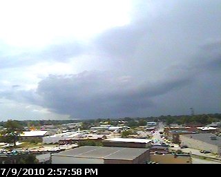
Thunder is rumbling at 3 pm. Note the very dark storm clouds just the northwest and west of Cookeville. Expect more storms in area now!
Sent from my Verizon Wireless Blackberry
BEST CHANCE FOR RAIN THIS MONTH:
Expect storms to develop during the day. Some of these storms could become strong to possibly severe today and early tonight as a cold front moves into our area. It is quite possible for us to see some locally heavy rain and minor flooding. Spotters are encouraged to report anything that reaches reporting criteria.
24-HOUR FORECAST:
We're expecting to only hit 85° this afternoon before rains move in. Low tonight in the upper 60's and lower humidity levels and a north wind will make our high of 87° on Saturday feel much more comfortable.
*Latest Local Forecast*
*Hazardous Weather Outlook*
*Latest Live Radar*
 |
| Click on graphic to see larger version |
Cookeville's Daily Almanac
Yesterday's high: 96°
Yesterday's low: 67°
Normal High: 87°
Record: 101° in 1988
Normal Low: 65°
Record: 53° in 1918
Last Year: 86° and 62°
2.03" of rain fell on this date in 1916
--------------------------------------------------
Join me on: Facebook Twitter LinkedIn Examiner.com Nashville Weather CookevilleTimes Weather My Google Profile
Thursday, July 8, 2010
Hot Today; Rain Coming Friday
ANOTHER HOT DAY AHEAD:
Expect highs to hit the lower to middle 90's once again today. We saw 94° on Wednesday. The great news is we'll see some changes by tomorrow (Friday) as a frontal boundary pushes closer to our area. Rain will help bring our temperatures down.
At 7 a.m. in Cookeville
 |
| Click on graphic to see a larger view! |
Cookeville's Daily Almanac
This Morning's Low: 66.7°
Yesterday's high: 94.1°
Yesterday's low: 65.1°
Normal High: 87°
Record: 98° in 1930
Normal Low: 65°
Record: 54° in 1984
Last Year: 84° and 61°
4.30" of rain fell on this date in 1979
--------------------------------------------------
Join me on:
Wednesday, July 7, 2010
Hot Today, Changes Come Friday
MUCH DESERVED BREAK:
After taking a few days off for the Independence Day holiday, I'm back in the saddle here at CookevilleWeatherGuy.comHOT WEATHER CONTINUES:
It'll warm up quickly this morning as high pressure continues to dominate our weather pattern. Expect 93° today and the same on Thursday, but changes loom on the horizon as Friday looks like our best chance for rain in the last 10 days! The weekend appears to be much cooler with highs in the middle 80's.Join me on:
Saturday, July 3, 2010
Independence Weekend Forecast
MARVELOUS RUN OF WEATHER AHEAD:
If warm (to nearly hot) sunshine-filled days and cool overnights are your definition of sensational weather, then I have great news for you....the next several days are going to be the cat's meow! Highs will trend from the middle and upper 80's to the lower 90's by mid-week. At night, we'll see lows (by sunrise) in the middle and upper 60's. An isolated shower chance enters our picture by Friday. See forecast below.SMITHVILLE JAMBOREE:

Do you enjoy great music, wonderful dancing, and people watching? The Smithville Jamboree is the place to be through Saturday night. Just a short drive from Cookeville, it is one of the premier fiddler competitions in the nation. As usual, Cookeville's public television station (WCTE) will have live coverage from Smithville. My family attended last night and it was great to see many of you who enjoy this blog. Thanks for coming up and introducing yourselves.
----------------------------------
Cookeville's Daily Almanac
July 3rd, 2010
 |
| Click on above image for better viewing |
This morning's low: 68.5°
Yesterday's high: 87.1°
Yesterday's low: 56.8°
Normal High: 87°
Record: 99° in 1925
Normal Low: 64°
Record: 50° in 1924
Last Year: 79° and 59°
2.60" of rain fell on this date in 1965
--------------------------------------------------
Join me on:
Friday, July 2, 2010
Gorgeous Weekend Ahead

Very Nice Holiday Weekend:
July 4th is rapidly approaching and our weather will be quite nice considering we're right in the middle of summer. We started out this morning with a low of 57°. Expect a high this afternoon in the middle 80's and warming each day with 87° on Saturday, and 91° by Sunday. It'll be sunny during the day and clear at night with lows in the lower to middle 60's each evening.
At 8 a.m. in Cookeville, TN

Cookeville's Daily Almanac (7/2/10)
This morning's low: 56.5°
Yesterday's high: 82.2°
Yesterday's low: 62.1°
Normal High: 87°
Record: 97° in 1926
Normal Low: 64°
Record: 46° in 1988
Last Year: 80° and 61°
" of rain fell on this date in
--------------------------------------------------
Join me on:
Thursday, July 1, 2010
Not A Bad Start For July
10:20 PM UPDATE:
Already down to 65° in Cookeville.
I expect mid to upper 50's by sunrise Friday!
Don't get too used to it as upper 80's to near 90 return soon. No rain until about Tuesday.
COMFORTABLE WEATHER ALERT:
Expect daytime highs to reach just 83° this afternoon after morning lows of 62°. I call this a fantastic start to July. We'll gradually warm each day as we go through the Independence Day holiday. By July 4th, we should see highs around 88°.Already down to 65° in Cookeville.
I expect mid to upper 50's by sunrise Friday!
Don't get too used to it as upper 80's to near 90 return soon. No rain until about Tuesday.
COMFORTABLE WEATHER ALERT:
FROM MIDNIGHT TO 7:45 THIS MORNING
 |
| For a larger image, please click on graphic |
--------------------------------------------------
Join me on:
Subscribe to:
Posts (Atom)
AMS
Member-American Meteorological Society