

Reporting weather from an experienced perspective.
Monday, August 31, 2009
No Complaints Monday
**VERY MUCH FALL-LIKE**
It is in the lower to mid 50's across the Middle Tennessee area this morning. Saw a 51° reading in McMinnville at 7 a.m. As the last day of August, this marks the end of meteorological summer. It really feels like Fall across the region. Expect middle 70's here in Cookeville today with temperatures rising throughout the week to around 80° by Thursday and Friday with only a slight chance for rain.
**Weather History for This Date**
2005-Remnants of Hurricane Katrina move across Middle TN. Clarksville, Crossville, and Nashville all record wind gusts of more than 40 mph. Nashville receives 1.97" of rain while Clarksville sees 2.02".
**Fun Weather Site of The Day**
Interested in weather? Here is a great place to start..the homepage for NOAA Weather
**Cookeville's Daily Almanac**
Yesterday's high: 78° low: 59°
Normal High: 85°
(Record: 98° in 1943)
Normal Low: 60°
(Record: 43° in 1946)
Last Year: 89° and 67°
3.09" of rain fell on this date in 1982
--------------------------------------------------
Be sure to join me on Facebook and request to be my friend. We have a great community of weather folks.
I'm also on Twitter and enjoy adding people to my 'following' list and invite you to 'follow' me. Twitter is a great way to keep up quickly!
Sunday, August 30, 2009
Beautiful Sunday
Sunshine with highs in the upper 70's across the Upper Cumberland region today. We'll be down in the middle 50's by sunrise on Monday. Enjoy this gorgeous Sunday ahead. The week ahead looks dry with highs near 80° and lows in the mid 50's to near 60.
Feel free to join us at Trinity Assembly in Algood, TN if you're in the area. For those of you outside our area or can't get out, our services (8:30 and 10:30 this morning) are live on the web, too. This is 'Jeans Sunday' as it is our Picnic Day. As a group who is on fire for Christ, the service promises to be an exciting and learning experience as evidenced in this YouTube video. Come be our guest today.
--------------------------------------------------
Be sure to join me on Facebook and request to be my friend. We have a great community of weather folks.
I'm also on Twitter and enjoy adding people to my 'following' list and invite you to 'follow' me. Twitter is a great way to keep up quickly!
Lastly, you can read my latest weather post over the Examiner website where I handle duties as the Nashville Weather Examiner.
Saturday, August 29, 2009
This Saturday Afternoon..
SHORT TERM FORECAST
NATIONAL WEATHER SERVICE NASHVILLE TN
246 PM CDT SAT AUG 29 2009
NATIONAL WEATHER SERVICE NASHVILLE TN
246 PM CDT SAT AUG 29 2009
TNZ009>011-029>034-066-292200-
MACON-CLAY-PICKETT-TROUSDALE-SMITH-JACKSON-PUTNAM-OVERTON-
FENTRESS-CUMBERLAND-
INCLUDING THE CITIES OF...LAFAYETTE...CELINA...BYRDSTOWN...
HARTSVILLE...CARTHAGE...GAINESBORO...COOKEVILLE...LIVINGSTON...
JAMESTOWN...ALLARDT...CROSSVILLE...FAIRFIELD GLADE
246 PM CDT SAT AUG 29 2009
.NOW...
LOOK FOR ISOLATED SHOWERS...AND POSSIBLY A THUNDERSTORM OR
TWO...TO CONTINUE MAINLY ALONG AND EAST OF A MOSS TO CARTHAGE
LINE AND ALONG AND NORTH OF INTERSTATE 40 THROUGH 500 PM.
TOTAL RAINFALL AMOUNTS WILL GENERALLY RANGE FROM AROUND ONE TENTH
TO AROUND ONE HALF OF AN INCH.
Sent from my Verizon Wireless BlackBerry
Cooler Temps Ahead
Good day to work outdoors across Middle Tennessee. While some will see isolated showers, many of us will have cloudy skies and temperatures in the lower 80's this afternoon. The rain will be associated with a second frontal passage later today. The first is across our coverage area now.

Expect partly sunny skies for Sunday and cooler temperatures behind the front. Much of next week will see highs only in the 70's and lows in the 50's across much of Middle Tennessee.
**Weather History for This Date**
2005: Hurricane Katrina pushed an incredible storm surge onshore in Louisiana, Mississippi, and Alabama, killing almost 2,000 people and causing more than $80 billion in damage. It was the costliest Atlantic hurricane in history, as well as the deadliest in the United States since the 1928 Okeechobee Hurricane.
2005-One of the strongest worded warnings I've ever read, is released by the National Weather Service office in New Orleans, regarding damage before Katrina strikes. Read it here....
Fun Weather Site of The Day
Want to be a 'Backyard Weather Reporter'? Today's FWSOTD is just for you!
--------------------------------------------------
Be sure to join me on Facebook and request to be my friend. We have a great community of weather folks.
I'm also on Twitter and enjoy adding people to my 'following' list and invite you to 'follow' me. Twitter is a great way to keep up quickly!
Friday, August 28, 2009
Wet Weekend Weather

We'll start your Friday out by letting you know to be on the lookout for showers today and Saturday. The good news is we should clear out for Sunday. Expect below normal temperatures for this time of year. Highs today should be around 80° while Saturday will be in the mid to upper 70's. Sunday should be sunny with highs in the 70's as well.
**PICNIC FORECAST**
The 17th annual Trinity Assembly Church Picnic is this Sunday at Cane Creek Park. As of this post, I expect we'll see partly cloudy skies with temperatures in the 70's. Some years we've had temperatures in the 90's, so it'll be a refreshing change this year!
**Weather History for This Date**
2005-Just after daybreak, a frightening report comes back from hurricane hunters and confirms forecaster's worst fears. Katrina is a monstrous Category 5 in the Gulf of Mexico. Katrina would devastate New Orleans and the Mississippi Gulf Coast the next day.
1983-Hurricane Barry strikes Mexico just 35 miles to the south of the Texas border. Hundreds of homes are destroyed, but no one is killed.
Fun Weather Site of The Day
Interested in Meteorology (the study of Weather)? The University of Illinois has an excellent weather web site that has all sorts of guides. Check it out today!
Cookeville's Daily Almanac
Yesterday's high: 83° low: 68°
Last Year: 83° and 66°
Normal High: 86°
(Record: 100° in 1936)
Normal Low: 61°
(Record: 49° in 1922 )
2.84" of rain fell on this date in 1992
--------------------------------------------------
Be sure to join me on Facebook and request to be my friend. We have a great community of weather folks.
I'm also on Twitter and enjoy adding people to my 'following' list and invite you to 'follow' me. Twitter is a great way to keep up quickly!
Hazardous Weather Outlook
From Nat'l Weather Service this morning..
THIS HAZARDOUS WEATHER OUTLOOK IS FOR MIDDLE TENNESSEE.
.DAY ONE...TODAY AND TONIGHT
A COLD FRONT PUSHING ACROSS THE REGION MAY BRING A FEW STRONG TO
LOCALLY SEVERE THUNDERSTORMS TO THE AREA TODAY AND EARLY TONIGHT.
.DAYS TWO THROUGH SEVEN...SATURDAY THROUGH THURSDAY
NO HAZARDOUS WEATHER IS EXPECTED AT THIS TIME.
.SPOTTER INFORMATION STATEMENT...
DUE TO THE BRIEF AND ISOLATED NATURE OF POSSIBLE SEVERE WEATHER...
SPOTTER ACTIVATION IS NOT ANTICIPATED.
Sent from my Verizon Wireless BlackBerry
Short Term Forecast
From Nat'l Weather Service....
.NOW...
THROUGH 9 AM...LOOK FOR LIGHT SHOWERS TO CONTINUE FROM AROUND FRANKLIN...
TO NASHVILLE AND NORTHWARD ALONG INTERSTATE 65...WITH RAINFALL AMOUNTS
TOTALING BETWEEN ONE AND TWO TENTHS OF AN INCH OVER THE NEXT 2 HOURS.
SPRINKLES...OR ISOLATED LIGHT SHOWERS CAN BE EXPECTED OVER THE
REMAINDER OF MIDDLE TENNESSEE AND THE PLATEAU. NO THUNDERSTORMS
ARE EXPECTED DURING THE NEXT COUPLE OF HOURS...BUT AN ISOLATED
THUNDERSTORM OR TWO MAY OCCUR LATER THIS MORNING.
Sent from my Verizon Wireless BlackBerry
Thursday, August 27, 2009
Hazardous Weather Outlook
Latest information from Nat'l Weather Service....
PICKETT-PUTNAM-OVERTON-FENTRESS-CANNON-DEKALB-WHITE-CUMBERLAND-
COFFEE-WARREN-GRUNDY-VAN BUREN-
949 AM CDT THU AUG 27 2009
THIS HAZARDOUS WEATHER OUTLOOK IS FOR MIDDLE TENNESSEE.
.DAY ONE...TODAY AND TONIGHT
A LOW PRESSURE SYSTEM OVER THE LOWER MISSISSIPPI VALLEY WILL HEAD
NORTHEAST. MOISTURE WILL INCREASE WITH SCATTERED SHOWERS AND
THUNDERSTORMS EAST OF INTERSTATE 65. A FEW SLOW MOVING CELLS IN
THE PLATEAU COULD PRODUCE TWO TO FOUR INCHES OF RAINFALL IN THE
CUMBERLAND PLATEAU REGION.
.DAYS TWO THROUGH SEVEN...FRIDAY THROUGH WEDNESDAY
THE CHANCE OF SHOWERS AND THUNDERSTORMS WILL CONTINUE FRIDAY AND
SATURDAY AS A COLD FRONT MOVES THROUGH SATURDAY NIGHT. THE
PROBABILITY FOR WIDESPREAD HAZARDOUS WEATHER IS LOW.
.SPOTTER INFORMATION STATEMENT...
SPOTTERS AND LOCAL EMERGENCY MANAGEMENT OFFICIALS ARE ENCOURAGED
TO REPORT HEAVY RAINFALL AMOUNTS TO THE NATIONAL WEATHER SERVICE
IN NASHVILLE.
Sent from my Verizon Wireless BlackBerry
Wednesday, August 26, 2009
Showers to our South
...NOW...
THROUGH 2 PM...ISOLATED SHOWERS WILL CONTINUE OVER PARTS OF
SOUTHEAST MIDDLE TENNESSEE. RAINFALL AMOUNTS WILL BE
LIGHT...AVERAGING BETWEEN ONE TENTH AND ONE QUARTER INCH. GENERAL
MOVEMENT IS TO THE NORTH AROUND 15 MPH.
Sent from my Verizon Wireless BlackBerry
Wonderful Wednesday Weather
**WARM WITH CHANGES COMING**
Hot weather will make it's presence felt in Middle Tennessee over the next couple of days as we'll see upper 80's in the Cookeville area. Expect 90+ near Nashville. An approaching front will drop temperatures for Friday through the weekend with rain chances on both Friday and Saturday. Highs will only be in the middle 70's for Sunday.
Weather History for This Date
2007-It is the 32nd day in a row that Nashville has hit 90°+
1995-Five tropical cyclones were going at the same time in the Atlantic basin, an all-time record.
Fun Weather Site of The Day
The Old Farmer's Almanac is an excellent site. Check it out today!
Cookeville's Daily Almanac
Yesterday's high: 87° low: 62°
Last Year: 71° and 67° with 1.59" of rain
Normal High: 86°
(Record: 100° in 1943)
Normal Low: 62°
(Record: 49° in 1917)
2.55" of rain fell on this date in 1979
--------------------------------------------------
Be sure to join me on Facebook and request to be my friend. We have a great community of weather folks.
I'm also on Twitter and enjoy adding people to my 'following' list and invite you to 'follow' me. Twitter is a great way to keep up quickly!
Tuesday, August 25, 2009
Continued Quiet Weather
***QUICK TUESDAY FORECAST***
Very nice day ahead with sunshine-filled skies and highs, in the Cookeville area, around 87°.
***TUESDAY MORNING NOTES***
We had another cool night overnight and this morning is quite pleasant. Lows were in the upper 50's across much of Middle Tennessee. Tonight will be more of the same, but add on a few degrees with lows in the lower 60's. The warming trend continues with highs near 90° on Wednesday. First chances for rain will be on Thursday and the rain chances (albeit, low) stick with us through the weekend. Expect temperatures to cool once again with highs only in the upper 70's by Sunday.
*Latest Local Forecast*
***DID YOU KNOW***
Do you recall August from two years ago? I came across this interesting post from my blog archive on the very hot August 2007. Check it out and it'll make you glad that weather is in our past! Hint..the daily high in Nashville averaged 99.9° through the first 25 days of August in 2007.
--------------------------------------------------
Be sure to join me on Facebook and request to be my friend. We have a great community of weather folks.
I'm also on Twitter and enjoy adding people to my 'following' list and invite you to 'follow' me. Twitter is a great way to keep up quickly!
Monday, August 24, 2009
Another Beautiful Morning

Middle and upper 50's are the rule across Middle Tennessee this morning under a clear sky. See the Cookeville web cam by clicking here. Expect highs to reach just 80° this afternoon in the Cookeville area with plenty of sunshine. Temperatures should rise each day this week as we'll see middle 80's on Tuesday and Wednesday and upper 80's by Thursday. Rain chances have been pushed back to Friday. A very nice, late-summer week in store.
*Latest Local Forecast*
**Weather History for This Date**
1876-Nashville receives 2.65" in one day.
1893-A hurricane makes landfall near the present-day JFK airport near New York City
1964-Hurricane Cleo strikes Haiti, killing nearly 200 people.
2007-Official high hits 104° here in Cookeville, check out my post from that day
Fun Weather Site of The Day
Wikipedia has a very nice weather portal that is full of information. Check it out today!
Cookeville's Daily Almanac
Yesterday's high: 73° low: 58°
Normal High: 86°
(Record: 104° in 2007)
Normal Low: 62°
(Record: 50° in 1997)
Last Year: 86° and 68°
1.77" of rain fell on this date in 1958
--------------------------------------------------
Be sure to join me on Facebook and request to be my friend. We have a great community of weather folks.
I'm also on Twitter and enjoy adding people to my 'following' list and invite you to 'follow' me. Twitter is a great way to keep up quickly!
Lastly, you can read my latest weather post over the Examiner website where I handle duties as the Nashville Weather Examiner.
Sunday, August 23, 2009
Late August or Late September
**RECORD-SETTING COOL TEMPERATURES**
Cool weather across Middle Tennessee makes us wonder if we are really in late August. Feels more like a late September weekend. Lows this morning were mostly in the mid and upper 50's with a couple of 55° readings being reported. In West Tennessee, Jackson reports a new record low for this date of 54° and it breaks the record of 55° set way back in 1956.
**SUNDAY MORNING NOTES**
Today's forecast calls for partly sunny skies with highs in the middle 70's here in Cookeville. Another cool night tonight with lows by sunrise of 55°. We'll gradually warm up next week with highs in the lower 80's on Monday moderating to the upper 80's by Thursday. First chances for any rain arrive around Thursday.
**Weather History for This Date**
1853-The World Meteorological Organization, originally known as the International Meteorological Organization, is found on this date.
1961-Baseball-sized hail is reported in Smith County, TN
1987-Strong Northwesterly winds caused upwelling in Lake Ontario. Water temperatures on the north shore were a chilly 41°, while on the south side they were 71°.
**Cookeville's Daily Almanac**
Yesterday's high: 76° low: 61°
Normal High: 86°
(Record: 100° in 2007)
Normal Low: 62°
(Record: 47° in 1956)
Last Year: 91° and 72°
1.20" of rain fell on this date in 1966
--------------------------------------------------
Be sure to join me on Facebook and request to be my friend. We have a great community of weather folks.
I'm also on Twitter and enjoy adding people to my 'following' list and invite you to 'follow' me. Twitter is a great way to keep up quickly!
Lastly, you can read my latest weather post over the Examiner website where I handle duties as the Nashville Weather Examiner.
Friday, August 21, 2009
Fall-Like Weekend Ahead
***FRONTAL PASSAGE***
Expect quite a change for our weekend weather! Today, we'll see on and off clouds with a chance of some light rain. Otherwise, temperatures will sneak up into the lower 80's this afternoon. The approaching cold front should sweep through the Cookeville area by 2 pm CDT. This will lower our humidity levels and take our temperatures down 10+° from where they've been the past week. A slight shower chance for Saturday with highs only in the upper 70's. Sunday will be even cooler with highs in the middle 70's under sunny skies. Lows at night will drop all the way to the 50's by daybreak on Sunday and Monday!
***UPGRADES TO WEBSITE***
One item people look for on my site is rainfall amounts. So, I've added under "Cookeville, TN Climate Data" a section called "2009 Cookeville, TN Rainfall". It is updated monthly to show what has been recorded at my CoCoRaHS station. Hope you enjoy this new feature. You can still get daily rainfall amounts by visiting the CoCoRaHS web site and looking at my daily updates. I try to report what was captured in my gauge and others in the area, if necessary
***NEW FROM COCORAHS & NWS***
Each day, the Nashville office of the National Weather Service puts out a map of rainfall recorded across Middle Tennessee by CoCoRaHS observers. Below is an example from today, click on it for a larger view. Here is the daily link.

Weather History for This Date
1983-Crossville reports it's highest August temperature ever at 99°...
Get out and enjoy this beautiful weekend!
--------------------------------------------------
Be sure to join me on Facebook and request to be my friend. We have a great community of weather folks.
I'm also on Twitter and enjoy adding people to my 'following' list and invite you to 'follow' me. Twitter is a great way to keep up quickly!
Lastly, you can read my latest weather post over the Examiner website where I handle duties as the Nashville Weather Examiner.
Thursday, August 20, 2009
Rain Not Over
According to latest information, we expect showers to re-fire across Middle Tennessee late this afternoon, through the evening, and overnight as a cold front approaches from the west. Showers will linger through Friday for much of Tennessee and eastern sections of Middle Tennessee could see some light sprinkles on Saturday.
*Latest Local Forecast*
*Latest Local Forecast*
Short Term Forecast
From Nat'l Weather Service at 1:54 PM...
.NOW...
LOOK FOR SCATTERED SHOWERS AND THUNDERSTORMS TO CONTINUE EARLY
THIS AFTERNOON ACROSS PORTIONS OF MIDDLE TENNESSEE MAINLY EAST
OF INTERSTATE 65. THE STRONGER STORMS WILL PRODUCE OCCASIONAL
LIGHTNING, WITH SMALL HAIL, GUSTY WINDS, AND BRIEF HEAVY RAINFALL.
THE CELLS ARE MOVING NORTHEASTWARD AROUND 20 MILES AN HOUR.
Sent from my Verizon Wireless BlackBerry
Storms In TN
...LINE OF STRONG THUNDERSTORMS MOVING ACROSS MIDDLE TENNESSEE...
AT 1259 PM, DOPPLER RADAR SHOWED A NEARLY SOLID LINE OF
THUNDERSTORMS MOVING EASTWARD ACROSS MIDDLE TENNESSEE. THE LINE
REACHED FROM LAFAYETTE, TO LEBANON, TO SMYRNA, TO CULLEOKA, TO
IRON CITY, WITH MOVEMENT AROUND 25 MILES AN HOUR. YOU CAN EXPECT
OCCASIONAL LIGHTNING WITH THIS LINE, AND SOME OF THE STRONGER
CELLS WILL PRODUCE SMALL HAIL AND WIND GUSTS AS HIGH AS 40 MILES
AN HOUR, ALONG WITH BRIEF, HEAVY RAINFALL.
Sent from my Verizon Wireless BlackBerry
Strong Storms Later...
**STRONG WEATHER POSSIBLE**
It is a beautiful start to our Thursday morning, however strong storms are a possibility later. Daytime heating will gives us a chances of the afternoon and early evening thunderstorms. Then, a cold front will push through Tennessee tonight setting off potentially strong storms. Persons living in Middle and West Tennessee are under the greatest chance while persons to the east of Cookeville should see lower chances for any severe weather to develop.
**RAIN IN OUR GAUGES**
Speaking of rain, most CoCoRaHS stations in Putnam County received just under a half-inch up to three-fourths of an inch Wednesday. August has been dry compared with all of 2009. I've measured just 1.12" for this month. A station that is located 8 miles north of Dover, TN (near Land between the Lakes) in Stewart County had 4.77" of rain fall yesterday while a second one recorded 3.62".
**VERY NICE WEEKEND**
The good news is once the front passes, expect cooler temperatures and lower humidities. Highs this weekend will only be in the 70's! Very nice.
*Latest Local Forecast*
Weather History for This Date
1983-Nashville's high of 101° is the first of four straight 100+ degree days.
1970-The 8th deadliest tornado in Canadian history strikes Sudbury, Ontario
Cookeville's Daily Almanac
Yesterday's high: 85° low: 71°
Normal High: 87°
(Record: 101° in 1936)
Normal Low: 63°
(Record: 53° in 1940)
Last Year: 94° and 65°
1.76" of rain fell on this date in 1988
--------------------------------------------------
Be sure to join me on Facebook and request to be my friend. We have a great community of weather folks.
I'm also on Twitter and enjoy adding people to my 'following' list and invite you to 'follow' me. Twitter is a great way to keep up quickly!
Tuesday, August 18, 2009
Rain Chances Again Today
**RAIN BANDS ROLL THROUGH**
The remnants of what was once Tropical Storm Claudette will impact our area today. Rain showers are moving through now...see radar...We received .34" in the CoCoRaHS rain gauge yesterday evening. That more than doubles our August total with .63". Rain chances are 60% today, 50% tonight, 60% on Wednesday and Thursday.
**40 YEARS SINCE CAMILLE**
Today (August 18, 2009) marks the 40th anniversary of Hurricane Camille devastating the Mississippi Gulf Coast. It went in near Bay St. Louis and most intense part struck near Pass Christian. Camille killed 172 near the Coast alone. The last time hurricane hunters checked the storm, they discovered winds of 190 mph with gusts to 220. It would take years for the Gulf Coast to recover.
Weather History for This Date
1954-Nashville's high was 102° while the low was a miserable 79°.
Cookeville's Daily Almanac
Yesterday's high: 89° low: 70°
Normal High: 87°
(Record: 100° in 1936)
Normal Low: 63°
(Record: 52° in 1979)
Last Year: 90° and 58°
2.17" of rain fell on this date in 1930
--------------------------------------------------
Be sure to join me on Facebook and request to be my friend. We have a great community of weather folks.
I'm also on Twitter and enjoy adding people to my 'following' list and invite you to 'follow' me. Twitter is a great way to keep up quickly!
Monday, August 17, 2009
Special Weather Statement
...GUSTY WIND POSSIBLE THROUGH EARLY EVENING...
SCATTERED SHOWERS AND ISOLATED THUNDERSTORMS ASSOCIATED WITH
DECAYING TROPICAL STORM CLAUDETTE WILL CONTINUE THROUGH THE
AREA INTO LATE EVENING. BRIEF WIND GUSTS BETWEEN 30 AND 40 MPH
ARE LIKELY WITH THIS PRECIPITATION. THIS MAY BRING DOWN SMALL
TREE LIMBS AS WELL AS BLOW OVER LIGHTER OBJECTS.
Sent from my Verizon Wireless BlackBerry
IMG00351-20090817-1809.jpg

Sent from my Verizon Wireless BlackBerry
Rain Chances All Week
**RAIN AND MORE RAIN POSSIBLE**
We keep rain chances in our forecast each day this week. Precipitation chances are in the 40-50% range. Our Tuesday weather will be affected by the remnants of Tropical Storm Claudette which roared ashore around Fort Walton Beach, FL overnight. Claudette appears to be moving slower than first expected.
**TROPICS REPORT** (short and sweet)
Tropical Storm Ana is fizzling out and not expected to grow while Bill is now a hurricane with maximum sustained winds of 75 mph.
Weather History for This Date
2007-Lafayette (105), Portland (105), and Woodbury (109) set all-time record highs
1969-Aircraft measuring Hurricane Camille's strength note a reading of 190 mph sustained winds with a 220 mph gust. They also get a barometer reading of 905 millibars or 26.73", the lowest ever recorded. Camille has exploded into a dangerous, Category 5 hurricane and is just 100 miles off the Mississippi Gulf Coast.
Fun Weather Site of The Day
Today's FWSOTD stays with the Hurricane/Tropical theme. It is called the Caribbean Hurricane Network and is found by going to STORM CARIB. This site is a network of people who live in and around the Caribbean Islands. As storms approach, it is very interesting to read what they write. Real people who face real danger. Check them out today!
Cookeville's Daily Almanac
Yesterday's high: 89° low: 70°
Normal High: 87°
(Record: 102° in 2007)
Normal Low: 63°
(Record: 50° in 1979)
Last Year: 85° and 55°
2.76" of rain fell on this date in 1944
--------------------------------------------------
Be sure to join me on Facebook and request to be my friend. We have a great community of weather folks.
I'm also on Twitter and enjoy adding people to my 'following' list and invite you to 'follow' me. Twitter is a great way to keep up quickly!
Lastly, you can read my latest weather post over the Examiner website where I handle duties as the Nashville Weather Examiner.
Sunday, August 16, 2009
Look What Is Headed Our Way!
1:00 PM Central Daylight Time
Information on Tropical Storm Claudette.
Courtesy: Nat'l Hurricane Center-Miami, FL
Position: 83 miles due south of Panama City, FL
Moving: North NorthWest @ 14 mph
Winds: 50 mph sustained with a recorded 63 mph gust
Expectations...T.S. Claudette is expected to continue a NNW track into the panhandle of Florida this evening with waves 3-5 foot above normal, possible trees and signs down due to winds. Rainfall amounts will be on the order of around 3" in the heaviest spots. Some isolated locations may receive up to 5". Claudette will move quickly to the northwest into Alabama. By 7 pm on Monday evening, it should be downgraded to a depression and be in the extreme northwest part of Alabama. Expect this storm to impact our weather in Cookeville with showers and thunderstorms by Tuesday. A 36-hour track is shown below.

--------------------------------------------------
Be sure to join me on Facebook and request to be my friend. We have a great community of weather folks.
I'm also on Twitter and enjoy adding people to my 'following' list and invite you to 'follow' me. Twitter is a great way to keep up quickly!
Lastly, you can read my latest weather post over the Examiner website where I handle duties as the Nashville Weather Examiner.
Super Sunday Weather

We awake this morning with warm sunshine. Expect another hot day with highs around 88° this afternoon and I cannot rule out a thunderstorm or two in our area. Low of 70° tonight with a slight chance of rain. Chances increase to 50% on Monday with highs in the middle 80's.
*Latest Local Forecast*
**TROPICS VERY ACTIVE**
In the last 24 hours, we went from one tropical storm to three! Ana, Bill, and Claudette (officially still called T.D. #4) are or will be named storms. First, Claudette is just off the west coast of Florida and is expected to gather more strength and turn to the NNW. On this track, it should affect the Florida and Alabama gulf coasts by early Monday morning. A tropical storm warning has been issued for those areas. T.S. Ana is churning in the Atlantic and is headed toward the Leeward Islands. Finally, T.S. Bill is in wide-open waters. The thinking now is Bill will re-curve toward the northern Caribbean and affect the east coast of the U.S.
Weather History for This Date
**2007**-In the midst of one of the worst droughts in Middle Tennessee's history, the temperature at Nashville climbs to 106 degrees, setting a record high for the month. It is only the fifth time in Nashville's history that this mark has been hit. It is the fifth consecutive day with 100+ degree readings -- the 9th in the last ten days -- and also the twelfth consecutive day of at least 99 degrees. Waverly sets a new all-time record high with a 106-degree reading, and Linden ties its record high at 105.
Fun Weather Site of The Day
Today's FWSOTD is called STORM PULSE. With Storm Pulse, you can track tropical systems like a professional. They are so many great tools on this site. One of my personal favorites tells you how far the storm is from to a point on the map. Another favorite is what the expectation of the storm's strength will be over a certain period of time. Check out Storm Pulse today!
Cookeville's Daily Almanac
Yesterday's high: 91° low: 68°
Normal High: 87°
(Record: 102° in 2007)
Normal Low: 63°
(Record: 50° in 2004)
Last Year: 81° and 62°
3.57" of rain fell on this date in 1964
Through the first 15 days of August, daily high temperatures are 2° below normal.
--------------------------------------------------
Be sure to join me on Facebook and request to be my friend. We have a great community of weather folks.
I'm also on Twitter and enjoy adding people to my 'following' list and invite you to 'follow' me. Twitter is a great way to keep up quickly!
Saturday, August 15, 2009

Hot Weekend and Active Tropics
**HOT AND DRY TODAY**
First, expect several hot days in a row across Middle Tennessee with highs near 90° here in the Cookeville area. While some may see one or two pop-up showers, don't expect any today. Sunday-Wednesday is a different story as chances increase each day for the rainfall. 10% at the most for Sunday up to a 40% chance by Tuesday.
**TROPICS ARE HEATING UP**
Next up on the list is the continuing tropical development in the Atlantic. It was for good reason we decided to feature the Nat'l Hurricane Center as the Fun Weather Site of the day this past Wednesday. Tropical Storm Ana is the first named storm of the 2009 season. Conditions are very favorable for continued development as well as a westward movement toward the U.S. mainland. While still 1000 miles east of the Leeward Islands, this storm bears watching. I've included a link to a website called STORMPULSE. They may have the best graphics of anyone on the web. Best of all, it is free!
**MORE THAN JUST ANA**
Not only is Ana looking very favorable for development, there is another area of disturbed weather that is east of Ana and is likely to become a named storm. If they both pan out, I'd consider next weekend the prime-time for two hurricanes to be all over the newscasts.
Weather History for This Date
1969-Camille reaches hurricane status this date. It would go on to wreck the Mississippi Gulf Coast and is considered by many to the most (along with Katrina) devastating hurricane to hit that area. Excellent story on Camille by our friends at AlabamaWX.com.
1954-A heatwave assaults Middle Tennessee as Nashville goes over 100° for the second day in a row.
Fun Weather Site of The Day
Don't laugh at this one, but I'm featuring my own web site as the FWSOTD. I know, I know..many of you are asking this: Why in the world would you feature your own web site, Michael? Here is the short and quick answer. Someone I respect pointed out a couple of ideas they had for changes to my site. I went ahead and made the changes and want feedback. So, at the risk of getting hammered, here is my e-mail address for comments!
Cookeville's Daily Almanac
Yesterday's high: 90° low: 65°
Normal High: 87°
(Record: 98° in 2007)
Normal Low: 64°
(Record: 49° in 2004 )
Last Year: 82° and 61°
1.62" of rain fell on this date in 1920
**LAST, BUT NOT LEAST** (July Review)
Finally, a quick look back at July. For the entire state of Tennessee, July was the 3rd coolest ever and it was one of the rainiest in history, too. A story from NOAA about July is available here.
--------------------------------------------------
Be sure to join me on Facebook and request to be my friend. We have a great community of weather folks.
I'm also on Twitter and enjoy adding people to my 'following' list and invite you to 'follow' me. Twitter is a great way to keep up quickly!
Friday, August 14, 2009
Nice Weekend Ahead
 **HOT WEEKEND**
Some areas are dealing with fog this morning. That should burn off early and expect a sunny, hot day. Highs will be near 90° in Cookeville. Mostly clear overnight with lows in the lower 60's. On Saturday, much of the same with highs around 90° once again..only a very slight chance for showers and they will be scattered. Make it the same forecast for Sunday. Enjoy your weekend!
Increasing rain chances by Monday....I'm still not convinced at this point, but worth mentioning since it is in the forecast.
If you're planning a trip to Nashville or Knoxville today, TDEC (Tennessee Department of Environment and Conservation) has issued an AIR QUALITY ALERT for both metro areas and their surrounding counties.
Weather History for This Date
1930-3.98" of rain is recorded in Nashville on this date.
1812-Major hurricane strikes New Orleans, killing around 100 people
1996-At an airport north of Phoenix, AZ, a thunderstorm produces a record wind-gust of 114 mph
Cookeville's Daily Almanac
Yesterday's high: 86° low: 64°
Normal High: 87°
(Record: 96° in 1943)
Normal Low: 64°
(Record: 48° in 2004)
Last Year: 85° and 59°
1.26" of rain fell on this date in 1977
Wednesday, August 12, 2009
Dodging The Rain Bullet
**TENNESSEE'S HEAVY RAIN (not here!)**
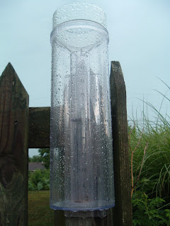
Quite a bit of rain fell yesterday across the Volunteer State. Unfortunately, not much fell in the Cookeville/Putnam County area as the most that was listed was just .05"....check out the rain in my gauge from this file photo in 2007.
 CoCoRaHS observers listed 37 reports of more than one inch including a 3.50" amount near Eagleville, TN in Williamson County just to the south of Nashville.
**REST OF WEEK**
Our weather turns dry after a slight chance of rain this afternoon. Highs will be in the mid to upper 80's through Friday when another chance for rain is in our weekend forecast. These rain chances will be for mostly isolated-type thunderstorms.
*Latest Local Forecast*
Weather History for This Date
1955-Hurricane Connie strikes North Carolina..5 days later, Hurricane Diane strikes in same location.
Fun Weather Site of The Day
Speaking of hurricanes, we have two potential hurricanes taking shape in the Atlantic. Right now, one is a Tropical Depression while the other is a vigorous tropical wave. So, our FWSOTD is the Nat'l Hurricane Center's web site. All kinds of information is available...check it out today! In other hurricane news, NOAA has decided to lower the number of anticipated storms this year, but cautions public to not let their guard down.
Cookeville's Daily Almanac
Yesterday's high: 87° low: 72°
Normal High: 88°
(Record: 99° in 1925)
Normal Low: 64°
(Record: 54° in 2008)
Last Year: 81° and 56°
1.51" of rain fell on this date in 1916
--------------------------------------------------
Be sure to join me on Facebook and request to be my friend. We have a great community of weather folks.
I'm also on Twitter and enjoy adding people to my 'following' list and invite you to 'follow' me. Twitter is a great way to keep up quickly!
Lastly, you can read my latest weather post over the Examiner website where I handle duties as the Nashville Weather Examiner.
Quite a bit of rain fell yesterday across the Volunteer State. Unfortunately, not much fell in the Cookeville/Putnam County area as the most that was listed was just .05"....check out the rain in my gauge from this file photo in 2007.

**REST OF WEEK**
Our weather turns dry after a slight chance of rain this afternoon. Highs will be in the mid to upper 80's through Friday when another chance for rain is in our weekend forecast. These rain chances will be for mostly isolated-type thunderstorms.
*Latest Local Forecast*
Weather History for This Date
1955-Hurricane Connie strikes North Carolina..5 days later, Hurricane Diane strikes in same location.
Fun Weather Site of The Day
Speaking of hurricanes, we have two potential hurricanes taking shape in the Atlantic. Right now, one is a Tropical Depression while the other is a vigorous tropical wave. So, our FWSOTD is the Nat'l Hurricane Center's web site. All kinds of information is available...check it out today! In other hurricane news, NOAA has decided to lower the number of anticipated storms this year, but cautions public to not let their guard down.
Cookeville's Daily Almanac
Yesterday's high: 87° low: 72°
Normal High: 88°
(Record: 99° in 1925)
Normal Low: 64°
(Record: 54° in 2008)
Last Year: 81° and 56°
1.51" of rain fell on this date in 1916
--------------------------------------------------
Be sure to join me on Facebook and request to be my friend. We have a great community of weather folks.
I'm also on Twitter and enjoy adding people to my 'following' list and invite you to 'follow' me. Twitter is a great way to keep up quickly!
Lastly, you can read my latest weather post over the Examiner website where I handle duties as the Nashville Weather Examiner.
Tuesday, August 11, 2009
Storms Likely Today and Tonight
Beautiful Morning, Storms Later
A weak front is expected to pass through our area today. This front will bring showers and thunderstorms to Middle Tennessee. There is a possibility that some of these storms could reach severe levels with damaging winds, large hail, and plenty of lightning. Additionally, some storms could produce flooding rains for a brief time. Be careful if you're caught in one of these strong storms. Remember, if water is covering the roadways, TURN AROUND..DON'T DROWN!
Rest of week forecast
Tonight through the rest of the week...storm chances for tonight diminish on Wednesday and we expect Thursday to be sunny and warm with highs in the 80's. Storms return Thursday night through the weekend with highs in middle 80's and lows in the upper 60's.
*Latest Local Forecast*
Weather History for This Date
1999-Rare tornado in Salt Lake City, Utah kills one and injures more than 100 people.
1998-Lightning strikes and kills a man working in tobacco field in Overton County (near Livingston). Two others nearby are injured
Cookeville's Daily Almanac
Yesterday's high: 90° low: 73° (heat index hit 100° at 3:34 pm)
Normal High: 88°
(Record: 98° in 1980)
Normal Low: 64°
(Record: 51° in 1967)
Last Year: 81° and 59°
2.44" of rain fell on this date in 2006
--------------------------------------------------
Be sure to join me on Facebook and request to be my friend. We have a great community of weather folks.
I'm also on Twitter and enjoy adding people to my 'following' list and invite you to 'follow' me. Twitter is a great way to keep up quickly!
Lastly, you can read my latest weather post over the Examiner website where I handle duties as the Nashville Weather Examiner.
Saturday, August 8, 2009
Hot Sunday
Expect another hot day on Sunday as highs in the Cookeville area will go above 90°. Saturday's high was 89° and we saw 88° as our high on Friday.
The heat index peaked at 95° late in the afternoon on Saturday. Be prepared for heat index readings to be at least that high on Sunday afternoon.
Next good chance of rain comes Tuesday night and Wednesday.
--------------------------------------------------
Be sure to join me on Facebook and request to be my friend. We have a great community of weather folks.
I'm also on Twitter and enjoy adding people to my 'following' list and invite you to 'follow' me. Twitter is a great way to keep up quickly!
Lastly, you can read my latest weather post over the Examiner website where I handle duties as the Nashville Weather Examiner.
Thursday, August 6, 2009
Welcome to Summer (Finally!)

Typical summer-like conditions through Sunday here in the Cookeville area. Highs today will reach 86°, but will feel more like mid 90's...repeat that for Friday and we'll go over 90° both Saturday & Sunday. No rain in the forecast through at least Monday.
*Latest Local Forecast*
Weather History for This Date
1947-Nashville hits 100° for the third straight day.
1959-Hurricane Dot strikes the Hawaiian island of Kauai with 125 mph winds
Fun Weather Site of The Day
Interesting weather site today comes from the folks at Science Daily..check it out, it is our FWSOTD!
Cookeville's Daily Almanac
August 6th
Yesterday's high: 81° low: 67°
Normal High: 88°
(Record: 101° in 1930)
Normal Low: 65°
(Record: 53° in 1957)
Last Year: 90° and 70°
.91" of rain fell on this date in 1993
--------------------------------------------------
Be sure to join me on Facebook and request to be my friend. We have a great community of weather folks.
I'm also on Twitter and enjoy adding people to my 'following' list and invite you to 'follow' me. Twitter is a great way to keep up quickly!
Lastly, you can read my latest weather post over the Examiner website where I handle duties as the Nashville Weather Examiner.
Wednesday, August 5, 2009
Rain Chances Again Today
**RAIN TODAY, THEN A HOT WEEKEND**
Rain chances today across the Cookeville area. Highs around 82°. Can't rule out some overnight fog developing and may see the fog become dense in areas by sunrise on Thursday. The afternoon highs for Thursday through Sunday will go from 87° to as high as 92° by both Saturday and Sunday (near 97° in the vicinity of Nashville). Only a very slight chance of a popup thunderstorm over the weekend. This will be the hottest weather since the middle part of June.
Big thunderstorms last evening. Saw some statistics that indicated as many as 15,000 lightning strikes in a 30 minute period over Middle Tennessee. Several storm damage reports here. We were spared the heavy rains here in Cookeville where only .05" was recorded at my location.
**LOUISVILLE FLOODING**
Looked up some rainfall numbers, from CoCoRaHS, near Louisville, KY where several sections of the city, including the famous Churchill Downs racetrack were under water due to flooding yesterday. They range from just over 3" up to 5.62" and most of this fell over a very short period of time. Coverage from WHAS television.
**SPEAKING OF COCORAHS**
 I've gotten this question several times and it is answered at the Message of The Day from the CoCoRaHS website...Where can I purchase an "Official CoCoRaHS 4" Diameter Rain Gauge"?
Great Question. We ask all of our CoCoRaHS volunteers across the country to use the same type of rain gauge to standardize our measurements and get the most accurate data we can. That gauge is the "4-inch diameter high capacity rain gauge", which measures to the one hundredth of an inch and holds up to 11 inches of precipitation. Our studies have shown that this (and the NWS 8" diameter gauge which can cost hundreds of dollars) gauge is the most accurate for measuring precipitation, especially intense rainfall and measuring snow.
So where can I obtain one? There are two rain gauge distributors offering our gauge at the special price of $23 plus shipping. Those are: WeatherYourWay (www.weatheryourway.com) and Ambient Weather (http://www.ambientweather.com/strgloteprra.html). The turn around time on orders is very fast. There are other distributors out there on the Web and some local hardware stores might carry the gauge as well, but we can't guarantee this low price (we have seen the gauge advertised for as much as $59.00 or more).
Weather History for This Date
On this date in 1954, it is the 27th day in a row that Nashville hits 90+ degrees, it is also the 58th day out of the last 59 over 90°.
Cookeville's Daily Almanac
Yesterday's high: 91° low: 68°
Normal High: 88°
(Record: 100° in 1930)
Normal Low: 65°
(Record: 52° in 1929)
Last Year: 94° and 69°
1.70" of rain fell on this date in 1993
--------------------------------------------------
Be sure to join me on Facebook and request to be my friend. We have a great community of weather folks.
I'm also on Twitter and enjoy adding people to my 'following' list and invite you to 'follow' me. Twitter is a great way to keep up quickly!
Lastly, you can read my latest weather post over the Examiner website where I handle duties as the Nashville Weather Examiner.
Rain chances today across the Cookeville area. Highs around 82°. Can't rule out some overnight fog developing and may see the fog become dense in areas by sunrise on Thursday. The afternoon highs for Thursday through Sunday will go from 87° to as high as 92° by both Saturday and Sunday (near 97° in the vicinity of Nashville). Only a very slight chance of a popup thunderstorm over the weekend. This will be the hottest weather since the middle part of June.
Big thunderstorms last evening. Saw some statistics that indicated as many as 15,000 lightning strikes in a 30 minute period over Middle Tennessee. Several storm damage reports here. We were spared the heavy rains here in Cookeville where only .05" was recorded at my location.
**LOUISVILLE FLOODING**
Looked up some rainfall numbers, from CoCoRaHS, near Louisville, KY where several sections of the city, including the famous Churchill Downs racetrack were under water due to flooding yesterday. They range from just over 3" up to 5.62" and most of this fell over a very short period of time. Coverage from WHAS television.
**SPEAKING OF COCORAHS**

Great Question. We ask all of our CoCoRaHS volunteers across the country to use the same type of rain gauge to standardize our measurements and get the most accurate data we can. That gauge is the "4-inch diameter high capacity rain gauge", which measures to the one hundredth of an inch and holds up to 11 inches of precipitation. Our studies have shown that this (and the NWS 8" diameter gauge which can cost hundreds of dollars) gauge is the most accurate for measuring precipitation, especially intense rainfall and measuring snow.
So where can I obtain one? There are two rain gauge distributors offering our gauge at the special price of $23 plus shipping. Those are: WeatherYourWay (www.weatheryourway.com) and Ambient Weather (http://www.ambientweather.com/strgloteprra.html). The turn around time on orders is very fast. There are other distributors out there on the Web and some local hardware stores might carry the gauge as well, but we can't guarantee this low price (we have seen the gauge advertised for as much as $59.00 or more).
Weather History for This Date
On this date in 1954, it is the 27th day in a row that Nashville hits 90+ degrees, it is also the 58th day out of the last 59 over 90°.
Cookeville's Daily Almanac
Yesterday's high: 91° low: 68°
Normal High: 88°
(Record: 100° in 1930)
Normal Low: 65°
(Record: 52° in 1929)
Last Year: 94° and 69°
1.70" of rain fell on this date in 1993
--------------------------------------------------
Be sure to join me on Facebook and request to be my friend. We have a great community of weather folks.
I'm also on Twitter and enjoy adding people to my 'following' list and invite you to 'follow' me. Twitter is a great way to keep up quickly!
Lastly, you can read my latest weather post over the Examiner website where I handle duties as the Nashville Weather Examiner.
Tuesday, August 4, 2009
Severe Thunderstorm Watch
From the NWS....
THE NATIONAL WEATHER SERVICE HAS ISSUED SEVERE THUNDERSTORM WATCH
659 IN EFFECT UNTIL 9 PM CDT THIS EVENING FOR THE FOLLOWING AREAS
IN TENNESSEE THIS WATCH INCLUDES 17 COUNTIES
IN MIDDLE TENNESSEE
CLAY CUMBERLAND DAVIDSON
DEKALB FENTRESS JACKSON
MACON OVERTON PICKETT
PUTNAM ROBERTSON SMITH
SUMNER TROUSDALE VAN BUREN
WHITE WILSON
THIS INCLUDES THE CITIES OF...ALLARDT...BYRDSTOWN...CARTHAGE...
CELINA...COOKEVILLE...CROSSVILLE...GAINESBORO...GALLATIN...
GREEN HILL...HARTSVILLE...HENDERSONVILLE...JAMESTOWN...
LAFAYETTE...LEBANON...LIVINGSTON...MOUNT JULIET...NASHVILLE...
SMITHVILLE...SPARTA...SPENCER...SPRINGFIELD AND WHITE HOUSE.
Sent from my Verizon Wireless BlackBerry
Strong to Severe Weather Possible
**Possible Storms Later**
Thunderstorm chances will be on the increase today and tonight as a series of strong upper level disturbances move through Middle Tennessee. These could produce strong to severe storms with large hail and damaging wind gusts. Highs today in Cookeville will reach the upper 80's. Storm chances continue for Wednesday. Keep an eye to the skies and stay in touch by tuning in to local tv or radio. I will do my best to update via Blackberry as conditions warrant.
Interesting Public Information Statement on Cool & Wet July
Cookeville's Daily Almanac
Yesterday's high: 85° low: 60°
Normal High: 88°
(Record: 99° in 1930)
Normal Low: 65°
(Record: 54° in 1976)
Last Year: 93° and 63°
1.84" of rain fell on this date in 1942
--------------------------------------------------
Be sure to join me on Facebook and request to be my friend. We have a great community of weather folks.
I'm also on Twitter and enjoy adding people to my 'following' list and invite you to 'follow' me. Twitter is a great way to keep up quickly!
Lastly, you can read my latest weather post over the Examiner website where I handle duties as the Nashville Weather Examiner.
Monday, August 3, 2009
Beautiful Morning
Good Morning...starting off cool (around 60°) at 7 a.m. Gorgeous shot of our town below. Note the fog in the background!

Looking at a warm day across Middle Tennessee with highs around 85° here in Cookeville with reading closer to 90° in the Nashville metro area. After another cool overnight, rain chances increase for Tuesday with highs running up to 90°. Plan on about a 30% chance of thunderstorms (the afternoon pop-up type) each day the rest of the work week.
Weather History for This Date
1893 Carthage receives it's most rainfall ever for a single day with 8.93"
Cookeville's Daily Almanac
Yesterday's high: 81° low: 64°
Normal High: 88°
(Record: °in )
Normal Low: 65°
(Record: °in )
Last Year: 88° and 66°
1.07" of rain fell on this date in 1939
--------------------------------------------------
Be sure to join me on Facebook and request to be my friend. We have a great community of weather folks.
I'm also on Twitter and enjoy adding people to my 'following' list and invite you to 'follow' me. Twitter is a great way to keep up quickly!
Lastly, you can read my latest weather post over the Examiner website where I handle duties as the Nashville Weather Examiner.
Sunday, August 2, 2009
Good News Sunday!
***LITTLE, if any, RAIN TODAY***
The rain has moved out and we should have an excellent Sunday ahead! Expect highs to reach the lower 80's with gradual clearing. Fog develops later tonight with lows in the low 60's and warmer tomorrow with sunshine and a high near 85°.
Heavy rains never materialized here in Cookeville, however our friends in White County have measured more than 2+ inches overnight.
*Latest Local Forecast*
***CHECK US OUT LIVE***
Heading out in a few minutes to Trinity Assembly in Algood. If you don't attend church, can't get to your home church, or are interested, our services are LIVE ON THE INTERNET each Sunday at 8:30 a.m. and 10:30 a.m. Feel free to check it out..also, you're welcome to join us in person!
Cookeville's Daily Almanac
August 2nd
Yesterday's high: 86° low: 64°
Normal High: 88°
(Record: 97° in 1999)
Normal Low: 65°
(Record: 54° in 1930)
Last Year: 90° and 71°
2.09" of rain fell on this date in 2000
--------------------------------------------------
Be sure to join me on Facebook and request to be my friend. We have a great community of weather folks.
I'm also on Twitter and enjoy adding people to my 'following' list and invite you to 'follow' me. Twitter is a great way to keep up quickly!
Lastly, you can read my latest weather post over the Examiner website where I handle duties as the Nashville Weather Examiner.
Saturday, August 1, 2009
Flood Watch Continues
***Latest Update***
FLOOD WATCH
NATIONAL WEATHER SERVICE NASHVILLE TN
1010 PM CDT SAT AUG 1 2009
...FLOODING RAINS POSSIBLE TONIGHT AND SUNDAY MORNING...
.AN APPROACHING COLD FRONT FROM THE WEST WILL SET THE STAGE FOR
HEAVY RAINFALL ACROSS ALL OF MIDDLE TENNESSEE TONIGHT AND EARLY
SUNDAY MORNING. THESE RAINS FALL ON SATURATED GROUND FROM PREVIOUS
RAINFALL EARLIER.
Sent from my Verizon Wireless BlackBerry
10 PM Update
From the National Weather Service...the Short-Term Forecast..
954 PM CDT SAT AUG 1 2009
.NOW...
THROUGH 1 AM...SCATTERED SHOWERS WILL CONTINUE TO MOVE EAST
ACROSS THE CUMBERLAND PLATEAU REGION AND SOUTHEAST MIDDLE TENNESSEE...
WITH RAINFALL AROUND ONE TENTH INCH. ANOTHER ROUND OF PRECIPITATION
IS EXPECTED TO DEVELOP IN WEST MIDDLE TENNESSEE AND MOVE INTO THE
REGION AFTER MIDNIGHT. A FLASH FLOOD WATCH REMAINS IN EFFECT
ACROSS MIDDLE TENNESSEE OVERNIGHT.
Sent from my Verizon Wireless BlackBerry
Early Evening Update
Round 1 of showers are moving through the area at this hour. The heaviest rains are both north and south of the Cookeville area. We expect round 2 to develop later tonight and through the overnight hours toward morning.

*Latest Local Forecast*
May see some sunshine later in the day on Sunday.
--------------------------------------------------
Be sure to join me on Facebook and request to be my friend. We have a great community of weather folks.
I'm also on Twitter and enjoy adding people to my 'following' list and invite you to 'follow' me. Twitter is a great way to keep up quickly!
Lastly, you can read my latest weather post over the Examiner website where I handle duties as the Nashville Weather Examiner.
Hazardous Weather Tonight
Issued by National Weather Service in Nashville at...
455 PM CDT SAT AUG 1 2009
...FLASH FLOOD WATCH IN EFFECT THROUGH SUNDAY MORNING...
THIS HAZARDOUS WEATHER OUTLOOK IS FOR MIDDLE TENNESSEE.
.DAY ONE...TONIGHT
A LOW PRESSURE SYSTEM WILL MOVE INTO MIDDLE TENNESSEE TONIGHT.
SHOWERS AND THUNDERSTORMS ARE EXPECTED. TWO TO FOUR INCHES OF
RAINFALL IS POSSIBLE OVERNIGHT. A FLASH FLOOD WATCH IS IN EFFECT
SUNDAY MORNING...UNTIL 9 AM.
Sent from my Verizon Wireless BlackBerry
Breaking
Just issued...
...FLASH FLOOD WATCH IN EFFECT THROUGH SUNDAY MORNING...
THE NATIONAL WEATHER SERVICE IN NASHVILLE HAS ISSUED A
* FLASH FLOOD WATCH FOR A PORTION OF MIDDLE TENNESSEE...
INCLUDING THE FOLLOWING AREAS...BEDFORD...BENTON...CANNON...
CHEATHAM...CLAY...COFFEE...CUMBERLAND...DAVIDSON...DEKALB...
DICKSON...FENTRESS...GILES...GRUNDY...HICKMAN...HOUSTON...
HUMPHREYS...JACKSON...LAWRENCE...LEWIS...MACON...MARSHALL...
MAURY...MONTGOMERY...OVERTON...PERRY...PICKETT...PUTNAM...
ROBERTSON...RUTHERFORD...SMITH...STEWART...SUMNER...
TROUSDALE...VAN BUREN...WARREN...WAYNE...WHITE...WILLIAMSON
AND WILSON.
* THROUGH SUNDAY MORNING
* WIDESPREAD SHOWERS AND THUNDERSTORMS WILL MOVE IN FROM THE
SOUTHWEST DURING THE LATE AFTERNOON AND BECOME MORE NUMEROUS
OVERNIGHT INTO SUNDAY MORNING. THE STORMS WILL PRODUCE HEAVY
DOWNPOURS WITH 2 INCH RAINFALL TOTALS QUITE COMMON...WITH
LOCALLY HIGHER AMOUNTS POSSIBLE.
* THIS RAIN WILL FALL ON GROUND THAT IS ALREADY SATURATED FROM
PREVIOUS RAINS...INCREASING THE RUN OFF POTENTIAL.
PRECAUTIONARY/PREPAREDNESS ACTIONS...
A FLASH FLOOD WATCH MEANS THAT CONDITIONS MAY DEVELOP THAT LEAD
TO FLASH FLOODING. FLASH FLOODING IS A VERY DANGEROUS SITUATION.
YOU SHOULD MONITOR LATER FORECASTS AND BE PREPARED TO TAKE ACTION
SHOULD FLASH FLOOD WARNINGS BE ISSUED.
Sent from my Verizon Wireless BlackBerry
Latest Update
Effective at:
220 PM CDT SAT AUG 1 2009
220 PM CDT SAT AUG 1 2009
.NOW...
BETWEEN NOW AND 400 PM...YOU CAN EXPECT AN AREA OF NUMEROUS
SHOWERS AND THUNDERSTORMS TO CROSS THE TENNESSEE RIVER...BETWEEN
CAMDEN AND SAVANNAH...AND SPREAD ACROSS MUCH OF WESTERN MIDDLE
TENNESSEE. THE THUNDERSTORMS WILL CONTAIN HEAVY DOWNPOURS...WHICH
WILL LIKELY CAUSE PONDING OF WATER IN LOW LYING AREAS...ESPECIALLY
IN LOCATIONS THAT RECEIVED HEAVY RAINFALL EARLIER THIS WEEK. MUCH
OF WESTERN MIDDLE TENNESSEE RECEIVED OVER 2 INCHES OF RAIN BETWEEN
WEDNESDAY AND FRIDAY...AND ANY ADDITIONAL HEAVY RAINS WILL CAUSE
RAPID RUN OFF...AND PONDING OF WATER. MOTORISTS SHOULD KEEP THIS
IN MIND WHEN DRIVING THROUGH HEAVY DOWNPOURS THIS AFTERNOON. IN
ADDITION...SOME OF THE STRONGER THUNDERSTORMS WILL ALSO BE CAPABLE
OF PRODUCING GUSTY WINDS TO 40 MPH.
ELSEWHERE...ACROSS THE MID STATE...THUNDERSTORM DEVELOPMENT IS
EXPECTED TO REMAIN ISOLATED THROUGH 400 PM.
Sent from my Verizon Wireless BlackBerry
Special Weather Statement
From the National Weather Service office located in Nashville, TN
...NASHVILLE EXPERIENCED ITS 4TH COOLEST JULY ON RECORD...AND THE
WETTEST JULY SINCE 1984...
THE TEMPERATURE DURING THE MONTH OF JULY IN NASHVILLE AVERAGED 3.4
DEGREES BELOW NORMAL...MAKING IT THE 4TH COOLEST JULY IN NASHVILLE
AND THE COOLEST SINCE 1967. THERE WERE 6 LOWEST DAILY TEMPERATURE
RECORDS...EITHER TIED...OR BROKEN DURING THE MONTH.
THERE WERE ONLY 4 DAYS DURING THE MONTH OF JULY IN WHICH THE
TEMPERATURE REACHED OR EXCEEDED THE 90 DEGREE MARK. THIS TIES
THE ALL TIME RECORD ALSO SET IN 1967 FOR THE FEWEST DAYS WITH 90
DEGREES AND ABOVE DURING THE MONTH OF JULY. THE WARMEST
TEMPERATURE DURING THE MONTH WAS 92 DEGREES ON THE 15TH...AND THE
COOLEST WAS 57 DEGREES ON THE 19TH.
THIS WAS THE WETTEST JULY IN NASHVILLE SINCE 1984...AND THE 22ND
WETTEST OUT OF THE LAST 138 YEARS THAT RECORDS HAVE BEEN KEPT.
RAINFALL FOR JULY 2009 TOTALED 6.03 INCHES WHICH IS 2.26 INCHES
ABOVE NORMAL. NORMAL RAINFALL FOR JULY IS 3.77 INCHES.
THE FIRST FULL YEAR OF WEATHER RECORDS IN NASHVILLE DATES BACK TO
1871.
Sent from my Verizon Wireless BlackBerry
Subscribe to:
Posts (Atom)
AMS
Member-American Meteorological Society