Wednesday, August 29, 2012

Taking A Leave

The Cookeville Weather Guy is enjoying a much needed and well deserved rest between the later afternoon of August 29, 2012 and September 9, 2012.

Your loyalty is very much appreciated. Cookeville's official forecast is below.

*Latest Local Forecast*


Monday, August 27, 2012

Sunshine and Hot For Monday

Expect mostly sunny skies with calm winds today and a high of 90°. It'll mark the 4th day in a row that we've topped 88°. Normal high this date is 86°. Tonight, skies become mostly cloudy with a low of 66°. An approaching front will bring a better chance for showers and thunderstorms with a high of 88° on Tuesday.

*Latest Local Forecast*


Isaac's path continues to confound the experts. The storm is now expected to move onto shore in Louisiana and move just west of New Orleans. As most of you know, it is the right side of the hurricanes that typically see the most damage. The system of levees will be tested in a major way for the first time since Katrina.

As far as Isaac affecting Tennessee, we believe the center of the storm will move into Arkansas. Since Isaac is such a large storm, it is possible to see heavy rainfall especially over west Tennessee.

Cookeville's Daily Almanac
August 27, 2012
Yesterday's high: 90.8° *first time at 90° in 16 days*
This morning's low: 63.2°
Normal: 86/62
Records: 100° in 1936 and 49° in 1922
Last year: 88/59

Rainfall 
0.00" at my station
August total: 5.64"
2012 total: 31.94"
2.84" of rain fell on this date in 1992

August continues to be a below average month in terms of temperatures but an above average month in terms of precipitation. Current temps are 2.3° below average and rainfall is about 10% ahead of an average August.

Interact with me on social media:
Weather Guy on Facebook
Weather Guy on Twitter
Cookeville Weather Alerts on Twitter


Sunday, August 26, 2012

Sunday's Forecast Including Impact Zone for Isaac

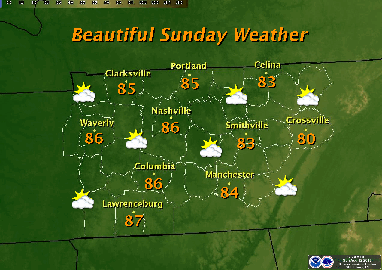
Expect a fantastic Sunday across much of Tennessee. We'll get to our forecast later in this post. Let's talk about Tropical Storm Isaac first.

A CONTINUED WESTWARD JOG:
We discussed, in last night's post, the possibility of the Tropical Storm Isaac's track scooting further to the west and this is exactly what has happened. The latest update (at 7 am) from the National Hurricane Center shows the impact point moving westward from the Destin area toward the Alabama/Mississippi border. This jog westward brings the city of New Orleans into play. Again, we're still a couple days out (late Tuesday and early Wednesday) so things could change.


ISAAC AFFECTING KEY WEST:
Isaac will continue to strengthen as it moves through the Gulf. The main impact point this evening will be Key West. The airport at Key West has been closed. Through the night Isaac will continue to grow and will become a category 1 hurricane. The beaches on the western gulf coast of Florida will take a beating especially since they are located on Isaac's east side. 50-60 mph wind gusts are being reported this morning as far away as West Palm Beach and Pompano Beach in rain bands on the Atlantic side of Florida.

Further out, the concern is for the Florida panhandle as landfall is expected between Tuesday night and Wednesday morning early.

TENNESSEE IMPACT FROM ISAAC:


In Tennessee we expect to see tropical like conditions by late Thursday and early Friday. The main threat continues to move westward so the heaviest rains (at this point) for late next week appear to be around Nashville and locations west toward Jackson, TN. Again all of this could change as Isaac marches towards Tennessee.

*Latest Local Forecast*


Cookeville area forecast discussion:
Expect sunny skies with a high near 90° today. Light winds

Partly Cloudy overnight and comfortable with a low of 65°

Monday will be similar to Sunday with a high of 90°

We'll add a chance of thunderstorms to the forecast beginning Monday night and extend that all the way through the rest of the week.


Interact with me on social media:
Weather Guy on Facebook
CookevilleWeatherGuy.com official page on Facebook
Weather Guy on Twitter
Cookeville Weather Alerts on Twitter


Saturday, August 25, 2012

10 PM Isaac Update

We are closely monitoring Tropical Storm Isaac and with the 10 pm (CDT) advisory, it is important to note several things going on with this system.

1) The storm is trying to reorganize after passing over land.
2) It appears the storm will continue to jog westward of the original line. This will move the storm further from the southwest Florida gulf coast.
3) Because the forecasting models are increasingly showing this movement west, it isn't out of the realm of possibility that landfall may end up nearer Mobile or even the Alabama/MS border.

A couple of forecast maps below.


The next question is "How will Isaac affect Tennessee?"

The short answer is this storm is expected to pull northward once on shore. Originally, the thoughts were the east TN mountains would see the most rainfall, however those thoughts are beginning to change. The cone of probability is more likely (right now) to be between Jackson, TN to the west and Crossville, TN to the east. Now it is entirely possible this will be adjusted as the storm moves closer and with 5 days to go, anything is possible.


*Latest Local Forecast*

Cookeville's Sunday forecast is for a sunny day with highs near 90°. The morning start around 7 am should be around 65° with an overnight low around 62°.


Interact with me on social media:
Weather Guy on Facebook
Weather Guy on Twitter
Cookeville Weather Alerts on Twitter


Nice Saturday


A great looking day across the Cookeville area for your Saturday with daytime highs reaching the upper 80's to near 90°. There is a very slight (10%) chance for an afternoon thunderstorm. Winds will be from the south southwest at around 5 mph but will become calm late today.

Overnight, expect a partly cloudy sky with a low of 65°. For Sunday, sunshine and a high of 89°. Thunderstorm chances ramp up for Monday and Tuesday. We think the area may be affected by Isaac at some point during the mid-week. That, however, is up in the air at this point. Weather Underground and Weather.com both have full coverage on Isaac.

*Wunderground Isaac Page*

*Latest Local Forecast*

Cookeville's Daily Almanac
August 25, 2012
Yesterday's high: 89.9° *first time at 90° in 16 days*
This morning's low: 65.6°
Normal: 87/63
Records: 100° in 1943 and 49° in 1917
Last year: 94/65

Rainfall 
0.00" at my station
August total: 5.64"
2012 total: 31.94"
1.77" of rain fell on this date in 1958


Interact with me on social media:
Weather Guy on Facebook
Weather Guy on Twitter
Cookeville Weather Alerts on Twitter


Midnight Update

1:00 AM UPDATE:
Isaac remains a tropical storm with 70 mph winds
and gusts to 85 mph 
*minimum hurricane strength is 74 mph*
Movement is NW @ 12 mph
Barometric pressure is 990mb or 29.22 inches 

-------------------------------------------------------------------


Suddenly, Isaac 'could' (and I mean could) impact middle Tennessee. Please understand we're at least a good 5-days out and this track could change significantly.

IF THE TRACK REMAINS THE SAME:
If you look real close, you'll notice a period where Isaac may be well out into the Gulf of Mexico as it rides up the coast of SW Florida. This, combined with extremely warm waters, may cause a significant amount of strengthening before Isaac strikes the northwest Florida coast between Pensacola, Destin, Ft. Walton Beach, and Panama City Beach.

Anyone who has relatives in these areas, I would encourage them to make plans now to at least be ready for a significant weather event. If they will not evacuate, encourage them to have a well-stocked storm kit.

I will continue to bring updates on Isaac as they are necessary.

TN WEATHER:
Weather for middle TN is going to be warm and pretty at least through the weekend! The forecast is below.

*Latest Local Forecast*


Interact with me on social media:
Weather Guy on Facebook
Weather Guy on Twitter
Cookeville Weather Alerts on Twitter


Thursday, August 23, 2012

Another Sunny Day After A Cool Start

If you're a fan of cool nights and warm sunny days then this is the weather for you. We start out the morning at 55.7° the fifth day in a row in the 50's. This afternoon temps will climb into the upper 80's with a calm wind and sunny, clear skies. Overnight, expect another cool night with lows near 60, I believe we'll drop down to the 50's for the sixth straight night. On Friday, we'll push 90°.

SUNNY SKIES THROUGH WEEKEND:
The pretty weather continues through the weekend with rain expected by Monday and Tuesday of next week.

AIR QUALITY ALERT:
A 'Code Orange' Air Quality Alert is in effect on Thursday (today) for counties surrounding the Nashville area. The closest one to Putnam County is Smith County to our west.


LATEST TRACK ON TROPICAL STORM ISAAC:
Residents of Florida BE ON THE LOOKOUT for Tropical Storm Isaac. The current track takes over the Dominican/Haiti this weekend and then onto Cuba Sunday and then into the Gulf near Key West on Monday and up the west coast of Florida Tuesday. It is still early and this track may change.

*Latest Local Forecast*

Cookeville's Daily Almanac
August 23, 2012
Yesterday's high: 84.3° 
This morning's low: 55.6°
Normal: 87/63
Records: 104° in 2007 and 50° in 1997
Last year: 91/58

Rainfall 
0.00" at my station
August total: 5.64"
2012 total: 31.94"
1.77" of rain fell on this date in 1958


Interact with me on social media:
Weather Guy on Facebook
Weather Guy on Twitter
Cookeville Weather Alerts on Twitter


Wednesday, August 22, 2012

Sunshine and Warm Through Sunday

We wake up once again to temperatures in the 50's across middle Tennessee. Here in Cookeville, the 7 am temp is 55.9° and the low this morning was 54.4°, the 4th straight morning with lows in the 50's.

SUNSHINE THIS AFTERNOON:
We'll hit 85° later this afternoon under a sunny sky. Ditto that forecast for tomorrow through the weekend as we stay in the dry pattern with warm days and cool evenings.


Tropical Storm Isaac is churning in the Atlantic and expected to reach hurricane status in the next 24-36 hours. The path is expected to take Isaac toward Cuba and then make a turn toward Florida. At this point, we expect the Atlantic coast of south Florida to be under the gun by around 2 am on Monday. This, however, is a long ways out and the path could easily change.

*Latest Local Forecast*

Cookeville's Daily Almanac
August 22, 2012
Yesterday's high: 82.4° 
This morning's low: 54.4°
Normal: 87/63
Records: 100° in 2007 and 47° in 1956
Last year: 87/58

Rainfall 
0.00" at my station
August total: 5.64"
2012 total: 31.94"
1.20" of rain fell on this date in 1966

Month-to-date highs for August are averaging 84.3°, which is 3° below normal and some 11° below the record heat from 2007. Low temps are running about 1° below normal but 6° above the coolest year ever, which was in 2004. Rainfall is nearly double the normal and most of us are thrilled with the extra rainfall. Did you know that nearly 11" had fallen thus far in August of 2010?


Interact with me on social media:
Weather Guy on Facebook
Weather Guy on Twitter
Cookeville Weather Alerts on Twitter


Sunday, August 19, 2012

Slight Forecast Change

Removed rain chances this afternoon. Expected highs around 80. Enjoy your Sunday.

Nice Sunday With A Possible Shower

After a nearly perfect Saturday where we saw highs in the lower 80's under sunny skies, we'll become more cloudy today with a slight chance at a rain shower this afternoon. Highs are expected to reach the lower 80's once again. A slight chance of rain tonight with a low in the upper 50's.

For the start of the work week we'll keep a chance of showers in for Monday however the rest of the week is expected to be sunny and quite nice with highs in the lower 80's early to mid 80's later this week. Lows will be mainly in the 50's.

*Latest Local Forecast*

Due to technical difficulties, there will be almanac today.


Interact with me on social media:
Weather Guy on Facebook
Weather Guy on Twitter
Cookeville Weather Alerts on Twitter


Friday, August 17, 2012

Shower and Thunderstorms Develop Today With A Nice Weekend

We'll go with a good chance of showers and thunderstorms developing later in the morning hours and during the early afternoon as a cold front approaches. We cannot rule out a strong storm as the front rolls through. I do expect the front to push through late this afternoon bringing cooler air into the area along with clearing skies.

The weekend looks sunny and beautiful with highs around 80, a north wind, and overnight lows in the 50's.

*Latest Local Forecast*


Interact with me on social media:
Weather Guy on Facebook
Weather Guy on Twitter
Cookeville Weather Alerts on Twitter


Thursday, August 16, 2012

Nice Start With A Warm Day Ahead

We began the morning at 59° and expect temperatures to warm up quickly after the sun rises. We'll top out at 87° this afternoon under a sunny sky. Winds are expected to be mainly calm.

Tonight, increasing clouds and a low around 69° and we'll see a slight chance of showers and thunderstorms. For Friday, showers and thunderstorms are likely with a high in the lower 80's. Rain chances continue Friday night, but the weekend is expected to be quite nice with highs in the 70's and lows in the 50's under sunny skies.

Much of next week will be cool and clear with warm, sunny days and very comfortable evenings.


Football Forecast:
The Cookeville High School 9th grade team takes on Pope John Paul II (JP2) tonight. JP 2 is coached by former longtime and very successful Cookeville coach Jerry Joslin. Kickoff is slated for 6 pm and I expect a temperature of 84° and light SSW wind at 2 mph. There is a very slight rain chance.

*Latest Local Forecast*

Cookeville's Daily Almanac
August 16, 2012
Yesterday's high: 84.4° 
This morning's low: 59.0°
Normal: 87/64
Records: 102° in 2007 and 50° in 1979
Last year: 84/57

Rainfall 
0.00" at my station
August total: 5.05"
2012 total: 31.35"
2.76" of rain fell on this date in 1944


Interact with me on social media:
Weather Guy on Facebook
Weather Guy on Twitter
Cookeville Weather Alerts on Twitter


Wednesday, August 15, 2012

Morning Fog Gives Way To Sunshine


Becoming mostly sunny today (after morning fog lifts - see webcam shot below) across the area with highs in the mid 80's. A northwest wind around 5 mph this afternoon. Overnight, a cool and comfortable evening with lows right around 60° and again areas away from the city of Cookeville will be cooler.


On Thursday, it'll be a mostly sunny day with highs in the upper 80's as the wind turns more southerly. We'll see shower chances develop on Thursday night along with cloudy skies. A low in the upper 60's. Showers and thunderstorms are likely on Friday with a high in the lower 80's. Chance of rain is 60%. The rain and thunderstorm chances hang on Friday night.

The weekend forecast is for a slight shower chance on Saturday morning and then becoming a mostly sunny day with highs near 80°. Mostly sunny on Sunday with highs in the low 80's. Lows this weekend will be in the upper 50's.

*Latest Local Forecast*


The above graphic shows the shortfall or deficit in rainfall for 2012. As you can see, we're still down by a significant amount. Thankfully, however, we have had some good rainfall (almost 9") in the last 30 days to cut into the shortage. 

Cookeville's Daily Almanac
August 15, 2012
Yesterday's high: 82.3° 
This morning's low: 65.1°
Normal: 87/64
Records: 102° in 2007 and 50° in 2004
Last year: 78/56

Rainfall 
0.00" at my station on Monday
August total: 5.05"
2012 total: 31.35"
3.57" of rain fell on this date in 1964

So far, high temps for August have been running a couple of degrees BELOW normal. Precipitation is significantly ahead of normal. All in all, August is a cooler, wetter month. Something we've not seen in quite a while. 


Interact with me on social media:
Weather Guy on Facebook
Weather Guy on Twitter
Cookeville Weather Alerts on Twitter


Tuesday, August 14, 2012

Slight Storm Chances This Morning; Nice Day Ahead


Look for a very nice day with highs in the lower 80's this afternoon as skies become partly sunny. We'll be cool once again overnight with lows in the lower 60's. Sunshine for Wednesday and Thursday with highs of 85° and 88° respectively. Storm chances return later this week and a cooler weekend on tap with sunny skies.

*Latest Local Forecast*

A NICE AND COOL RUN:
Between Saturday morning, Sunday morning, and Monday morning, we had lows in the 50's. This was the first time that had happened since June 5-9 earlier in the late spring.

Cookeville's Daily Almanac
August 14, 2012
Yesterday's high: 81.2° 
This morning's low: 66.9°
Normal: 87/64
Records: 98° in 2007 and 49° in 2004
Last year: 84/60

Rainfall 
0.05" at my station on Monday
August total: 5.05"
2012 total: 31.35"
1.62" of rain fell on this date in 1920


Interact with me on social media:
Weather Guy on Facebook
Weather Guy on Twitter
Cookeville Weather Alerts on Twitter


Monday, August 13, 2012

Lunch Update

A series of strong storms are marching across TN at the lunch hour. The atmosphere over here in Cookeville is more stable right now than west of us near Nashville. Hopefully, this fact will limit the intensity of the storms as they push eastward toward our area.

*National Weather Service - Nashville Office*

*Latest Local Forecast*


Interact with me on social media:
Weather Guy on Facebook
Weather Guy on Twitter
Cookeville Weather Alerts on Twitter


Sunday, August 12, 2012

Gorgeous Sunday


NOTHING LIKE THE 50's
A very cool start across the Cookeville area this morning as temps were in the 50's for the second morning in a row. We dropped to a low of 52.7° (the record low was 49° in 1964), which is the coolest morning reading since the sixth of June when we had a low of 50.6°.

**Don't forget to like our FACEBOOK page**


COMFORTABLE SUNDAY
Expect Sunday highs under sunny skies (see this morning's web cam shot above) to be around 83°, which is about 5° higher than yesterday's 78.5° maximum. It was just the third day this summer we hadn't been in the 80's, 90's, or 100's.

STORMS EARLY WEEK, BUT COOLER WEATHER COMING
Our work week will begin with a slight chance of storms on Monday with a better chance on Monday night and Tuesday. Expect warmer temperatures on Monday with highs in the mid-upper 80's and muggy-like conditions. After frontal passage on Tuesday, we'll be back down in the comfortable range (much like this weekend) and then temperatures heat up for the end of the upcoming week. By the weekend however, another front brings cooler weather once again.

*Latest Local Forecast*

Cookeville's Daily Almanac
August 12, 2012
Yesterday's high: 78.5° 
This morning's low: 52.7°
Normal: 87/64
Records: 98° in 1925 and 49° in 1967
Last year: 88/62

Rainfall 
0.00" at my station on Thursday
August total: 5.00"
2012 total: 31.30"
1.65" of rain fell on this date in 1937


Interact with me on social media:
Weather Guy on Facebook
Weather Guy on Twitter
Cookeville Weather Alerts on Twitter


Saturday, August 11, 2012

Great Weather News


WHO LIKES COOLER WEATHER:
An interesting 10-day forecast ahead. There are as many as three cold fronts poised to make their way through middle Tennessee over the next 10 days. We'll benefit from these with lower temperatures and much nicer conditions (lower humidity, lower dewpoints) during this time frame.

For today (Saturday), we'll reach the lower 80's this afternoon with sunny skies after a morning low of 57.1°. Look for Saturday night's low to be in the mid 50's by Sunday's sunrise. Highs on Sunday will reach the middle 80's. We'll become unsettled once again on Monday with warmer temps with the approach of another cold front and keep thunderstorms in the forecast Monday and Tuesday but we'll see another drop in temperatures by mid-week with highs in the lower 80's again.

Next weekend with the another front coming through gives us a similar weekend as this one with highs near 80° and lows in the 50's!

*Latest Local Forecast*


Interact with me on social media:
Weather Guy on Facebook
Weather Guy on Twitter
Cookeville Weather Alerts on Twitter


Friday, August 10, 2012

Rain This Morning; Great Weekend Ahead


Showers and thunderstorms are likely today, especially this morning, with a high of around 83°. I don't think it will be an all day washout and do see us having at least some partly cloudy skies later in the day.

Yesterday we saw heavy rains fall at lunch with 1.69" measured at my station. This gives us 4.89" for the month of August and that is 1.06" MORE than the entire month's average for August. Through 9 days, the typical average for August is 1.08".

The great news is we'll transition out of the rainy pattern and have a very nice weekend with plenty of sunshine and the high on Saturday struggling to reach the 80's and into the mid 80's for Sunday.

We've seen some showers this morning across the Cookeville area.

*Latest Local Forecast*

Cookeville's Daily Almanac
August 10, 2012
Yesterday's high: 81.8° 
This morning's low: 67.9°
Normal: 87/65
Records: 98° in 1980 and 51° in 1967
Last year: 88/65

Rainfall 
1.69" at my station on Thursday
August total: 4.91" (thru yesterday)
2012 total: 31.19"
2.44" of rain fell on this date in 2006


Interact with me on social media:
Weather Guy on Facebook
Weather Guy on Twitter
Cookeville Weather Alerts on Twitter


Thursday, August 9, 2012

Strong Storms - Significant Weather Advisory

Thunderstorms Through Friday


A good chance of thunderstorms throughout middle Tennessee today as we'll hit 90° again. Thunderstorms continue overnight and into Friday with a cooler weekend ahead.

At 7 am, rumbles of thunder are being heard across Cookeville as a thunderstorm has popped up just west of town. We expect this to be a recurring situation throughout the day. The biggest concern is that some storms may become severe with high winds, hail, and frequent (and dangerous) cloud to ground lightning.


*Latest Local Forecast*


Interact with me on social media:
Weather Guy on Facebook
Weather Guy on Twitter
Cookeville Weather Alerts on Twitter


Wednesday, August 8, 2012

Hot, Highs In The 90's

We return to stifling heat today across much of the area.

There is an Air Quality Alert for the surrounding counties near Nashville.

Look for highs to reach in the lower 90's here in Cookeville and middle 90's in much of the rest of middle TN. The heat will stay in place for Thursday but thunderstorm chances increase significantly with likely thunderstorms on Thursday night and again on Friday.

The weekend actually looks quite nice with chilly overnight temperatures around 60° and highs only in the lower 80's!

*Latest Local Forecast*

Cookeville's Daily Almanac
August 8, 2012
Yesterday's high: 88.4° 
This morning's low: 68.3°
Normal: 87/65
Records: 104° in 1930 and 48° in 1989
Last year: 92/69

Rainfall 
0.00" at my station (on Sunday)
August total: 3.20" (thru Sunday)
2012 total: 29.50"
1.76" of rain fell on this date in 1996

The average August high temperatures through the first week of the month are normal while precipitation is more than double the amount of normal. Back in 1942, there was 6.39" of rain recorded in the first week of the month.


Interact with me on social media:
Weather Guy on Facebook
Weather Guy on Twitter
Cookeville Weather Alerts on Twitter


Monday, August 6, 2012

More Rain Forecast For This Week

With more than 3" of rainfall recorded thus far in August, we're quickly making up ground lost to the drought over much of the area.

We usually don't celebrate a rain-filled weekend but with the lack of rain over the area, I don't think there were too many people complaining.

The rainfall amounts recorded over the last several days are as follows:
Friday: .80"
Saturday: 1.16"
Sunday: .82"
Monday (thus far): .41"

This gives us 3.19" for August. Typically, August averages just 3.83" for the entire month.


MONDAY FORECAST:
Expect a good chance for rain today with most coming in the morning. Thunderstorms may possibly develop later this afternoon. Chance of thunderstorms is 60% with an afternoon high of 85°. Temperatures will warm up for the rest of the week with highs topping 90° Tuesday-Thursday and a rain chance each day.


*Latest Local Forecast*

Cookeville's Daily Almanac
August 6, 2012
Yesterday's high: 82.4° 
This morning's low: 69.9°
Normal: 87/65
Records: 96° in 1991 and 50° in 2004
Last year: 79/71

Rainfall 
0.82" at my station (on Sunday)
August total: 2.78" (thru Sunday)
2012 total: 29.09"
1.97" of rain fell on this date in 2010


Interact with me on social media:
Weather Guy on Facebook
Weather Guy on Twitter
Cookeville Weather Alerts on Twitter


Sunday, August 5, 2012

Significant Weather Alert

Severe thunderstorms are moving into Putnam Court at 1:10 pm. Stay weather aware!

InteractiveNWS - Alert Information

Sunday Thunderstorms, Some Possibly Strong to Severe


Thunderstorms will be likely for your Sunday across much of the middle Tennessee region. Expect highs to climb into the upper 80's this afternoon. Some of these thunderstorms could reach severe limits and the National Weather Service believes there is a slight risk. The primary threats are damaging straight-line winds and large hail. Additionally, brief, localized flooding resulting from heavy rainfall is also possible.

*Latest Local Forecast*

*Saturday's Cocorahs Rainfall Map from Middle Tennessee*
Some impressive rain amounts from Saturday's storms in Middle TN. 3.18" in Wilson County, 2.22" in Trousdale County, 1.77" in Sumner County, and 1.40" in Putnam County.


Interact with me on social media:
Weather Guy on Facebook
Weather Guy on Twitter
Cookeville Weather Alerts on Twitter


AMS

AMS
Member-American Meteorological Society